Updated 30th August 1998; 19th February 1999; 9th January, 14th May 2000; 21st January, 23rd February , 5th May, 10th June, 16th October, 26th October 2001; 10th March, 6th May, 9th June, 11th November 2002; 24th January, 25th May, 18th October 2003; 7th January 2004; 3rd May, 13th June, 3rd July, 10th October, 6th November 2004; 30th July 2005; 1st February, 19th May, 4th October 2006; 5th, 28th October 2007; 22nd January, 2nd October 2008; 5th May, 2nd November 2009; 26th June 2010; 6th January, 28th June, 5th, 11th October 2011; 26th April, 25th September 2012; 24th April, 16th September 2013; 16th February, 16th May, 28th September, 17th October, 1st, 7th, 10th November, 5th December 2015; 10th February, 28th April, 9th May, 17th October, 5th, 30th November 2016; 21st May, 17th September, 18th November 2017; 16th February, 6th May, 28th, 30th June, 22nd September, 11th December 2018; 13th May, 26th July, 13th, 15th-17th September 2019; 30th October 2020; 20th June, 11th September, 16th November 2021; 9th January, 22nd February, 5th May, 4th, 10th, 12th June, 9th September, 25th November 2022; 19th February, 16th May, 2nd, 27th June, 20th September 2023; 17th February, 30th April, 11th, 15th, 29th May, 25th September, 27th November 2024; 26th February, 17th May 2025
There are 4 entrances to the system. (February 2025 - see below)
==================================================
NOTE
Tocadome: before and beyond (This note appears on the latest survey - 27/6/2023)
In 2021, surveying by the ECT Vallina Project connected the Tocadome to "enters large shaft". The connecting points appeared to be about 90m apart on the drawn master survey. The issue is the quality / reliability of the '94, '95 and 2021 survey data. The data from the resurveyed passages often differs wildly from the previous survey - certainly bearings are different and possibly lengths. The new centre line for New York City illustrates this problem.
The '21 data has been *EQUATE'd in 4 extra spots in order to make old and new survey "agree".
News about summer 2022 with survey data and subsequent trips is awaited(?).
An exploration journal for 2023 is available. Videos and a photo from exploration in the Tocadome and Novadome can be seen here.
Survey data and drawings are to follow and should be assimilated and available in due course.
Links to Exploration Diary 2021 : Exploration Diary 2021 with translation including notes and comments
Plans for 2022 : Explorations in 2023
==================================================
Explorations to be incorporated into the description below:
2012 summer : RH Passage before Swirl Chamber. See logbook 2/8/12
==================================================
The top entrance lies hidden in trees
a short walk down from a rough road (sign-posted Colorado) that sets off from the Arredondo-Alisas
road. The entrance is a 15m wide gash which would have been used for shelter
by people over the millennia and evidence of occupation has been found, both
flints and Bronze Age pottery. The discovery, deep inside the cave, of a small, whole pot (cubilete), possibly Bronze
Age, led to the re-opening, after possibly thousands of years, of the
second, bottom entrance (recently (2016) numbered 4382). A third entrance to the system was opened up in Torca de Rotura (0753), October 2022. A combined Vallina-Rotura Survex centre line in shown below and further details, e.g. an elevation appear on the Rotura description page. (Nov 2022). The length addition to Vallina (c108m) has been added above. The connection area was inspected in February 2023 with a view to fully exploring and surveying.
The 4th entrance is Cueva de la Rasa (5135).
The cave was first extended from the top
entrance in 1989 by the British. The cave was then pushed in subsequent
years by the Tortosa group for another 3km to about 12km. In 1994, after
the downstream boulder choke was passed the previous year, some 7km of new
cave was entered in joint trips with the Spaniards. The length
includes 3.5km of Tortosa finds in the early 90's which have been mainly
resurveyed and included.
For the Vallina Project 2021, the Espeleo Club Tortosa (ECT) organised a number of cavers from various Catalan caving clubs (32 people in total) to push on at various places in Vallina II.
The top entrance was used to test Ron Taylor's SubPhone in August 2016. A small loop aerial proved to be both easy to use and to give excellent communication results.
A number of aerial panoramic photos and videos were taken (13/11/2018) over areas of interest in the cave, including Vallina 1 and the end of Vallina 3.
Fifty metres into the 5m high cave, the floor slopes down to a flat mud floor halting straightforward progress at the limit of daylight. A draughting, excavated passage leads off from the back wall. A flat-out squeeze (that may need bailing in wet weather) and a short crawl lead to the top of a 10m pitch onto a steep slope down to a cracked mud floor and white calcite flow. Where the passage turns to head east, there is a tall, blind aven on the left. The passage continues, 10m wide and high, past some decaying antlers, to a 4m climb down. The route becomes larger over boulders and finally slopes down in a 20m wide and 25m high chamber, choked at the far end at floor level. The right hand wall consists of sand and boulders and a 23m climb up leads to a walk along the southern hand wall to a large roof tunnel and a fine, bouldery veranda looking back down into the chamber. This point is close (20m) to site 1823. Just beyond, 2.5m up behind a boulder on the right hand side, is the 1 x 1.5m entry to Gypsum Paradise.
Gypsum Paradise (survey batch 0733-23-02; length 40m)
A survey station cairn and paper marks a short rope climb (gear required?) entering this well decorated, initially walkable, passage. The route has gypsum wool and flowers.
After 3.6m the passage becomes narrower, turns to the left then goes straight for 12m, now crawling passage. A sharp right turn then 7m to another left turn reaching, after about 6.5m, extensive bat droppings (black and white). About 1.5m after a right turn, the last narrow crawl (lined on the left with gypsum) ends, after about 7m at a small hole 0.5x0.5m with no draught. In the middle of the last passage, there is a body-sized hole in the roof with no draught. (Photos.)
[Christine Ziebold]
The main tunnel continues as the Sunday Stomps for 250m passing some crystal
pools at the Glitter Run and emerging
into a chamber where the ways split. To the south,
the route skirts a pit and leads to
a muddy 25m pitch on a corner which was the original route to the lower levels.
The passage turns to the east and becomes the superb, sandy
Chunnel, 10m high and wide.
After 70m the floor rises to a wide, choked 15m deep pitch to the right while
straight ahead the route lowers to a short climb down through boulders to
a 30m pitch with a small, unexplored passage at the bottom. Just before this
pitch a climb leads into a large chamber where the draught is lost.
A crawl at the start of the Chunnel leads to a drop into a chamber with no
way out.
Top Level Continuation (TLC)
The bolt climb beyond the second pitch (marked "high level?" on surveys up to Easter 2023) and now called Ha! Aven was re-climbed past an old through-bolt to enter mainly walking, well-decorated passage. At Easter 2023 this was surveyed as batches 0733-23-01 and 23-03 with a total of 724m of new passage. Photos (batches 1, 2 and 3) with video and video
The 2023 bolt climb was close to the end of the passage, on the right-hand wall. Access is now up a rope further to the west with a traverse line installed at the top to allow access to the high level passage.(Details to follow)
Further exploration occurred in the summer 2023 when a high level traverse at the top of Ha! entered a passage (about 80m long, not surveyed) that headed west and ended at a pitch. A rock dropped here was later found in the "main passage about half way to exit". Further exploration at the Emily, Sophie, Jenny pitches area dropped a 20m pitch with a continuing drop and other leads. This remains unsurveyed and it is not clear where this pitch is. (See 2023 summer logbook, p54)
Further exploration (logbook, pp32-33) occurred in August 2024 where an "adjacent pitch" was descended, finding some "extra ropes down there" - (possibly Spanish). Further exploration didn't happen "as already explored but not on the survey". Also, a short distance into the upper series, " two tube like passages that went in a WNW direction" were found. "The first linked back to the a different part of the (adjacent) pitch. This could be a safer pitch head for the future. The second tube is shorter and has gypsum stuck to the wall. The rest has shelled off and can be revealed simply by turning over fallen slabs on the floor. (No surveying was carried out.)
NOTE: There are loose nuts on the traverse and on the Y hang bolts which have been hand tightened. Future trips should take a spanner to tighten them.
TLC Aven
Further back along the main passage from Ha! Aven, a new, awkward bolt climb was made over two days in August 2024 - TLC Aven, a height of about 29m. (Logbook, search for "0733".) Some surveying was carried out (batches 24-06 and partly repeated as 24-07) but, apparently, no drawings. The passage will show on the final survey as a rotated centre line.
[Within the passage at the top (Far Left Passage) there is a pitch that drops into the main route. The centre line survey shows this to be some 30m away from linking with the old, main passage centre line. However, when the old survey is fixed only to the top entrance, there is only 11m "error" and this may be accounted for by the width of the passage.]
The following description is edited from the logbook accounts:
A loose traverse goes across the top of the aven. (More passage at the end?) There is no more passage on the right of this area. The top of the aven is very well decorated in many long and beautiful straws.
At the (slightly) left side of the top of this aven is an obvious low sandy crawl which some rubble to be moved. The crawl is very loose and sandy, so quite comfortable, starting out mostly hands and knees height until a lovely big calcite formation, Fauna's Cake. After this, the crawl drops down to flat out for about 20m leading to a comfortably big chamber with a shallow muddy pit. The crawl continues low underneath a false calcite floor for a few short metres. A chamber is entered with calcite on the right wall and mud on the left, leading down into a rift. A bolted traverse goes across to the pitch which, disappointingly, drops into the known main route. Behind this traverse is another metre of sandy crawl to enter a bigger rift chamber that is very loose and appears to end in a T-junction above another massive drop (assumed to be the same passage as the first drop).
The usual route down into the middle of the cave lies near the Glitter
Run. The left hand passage at the split slopes down to the head of the
second pitch. Various bolt routes in avens all close down, except for one (see Top Level Continuation, below). The spacious second
pitch is split into drops of 12m and 18m and lands on boulders which slope
to the head of a 12m drop, passing under the 25m drop first used to enter
this series. At the base of the 12m drop, a small set of passages have been
pushed to chossy chokes and a strongly draughting choke after a climb down
in a rift.
At the top of the p12, the main route continues as walking or stooping for 150m, following
an inward draught and finishes at a steep, sandy slope down into a tall chamber
with a possible bolt route to a passage in the roof. Before the sandy slope
a passage on the right leads to some chambers and passages with a climb down
on the left dropping into B-flat Passage which leads to the base of
the 3rd pitch. On the left, near the top of the sandy slope are some passages
with nice gypsum formations.
A climb up of 3m on the right hand wall immediately leads to the head of the third, 13m pitch. There is a bolted climb to a choked passage above this pitch. At the base, the routes split: a slot leads directly to the remainder of the cave and will be described later; the wider route leads to the bottom entrance.
A slope and climb down of 4m passes Windy Corner and becomes wider at calcite. The passage continues in varied, comparatively small but easy going, past a number of openings, until a bouldery area is reached. It was at this point in the original explorations that a small clay beaker was found. A crawl and squeeze up over breakdown enters the bottom of an excavated 3m climb to reach the surface at Lost Pot Entrance (site 4382) behind a large, slumped section of hill side, about 100m lower than the altitude of the top entrance. The above paragraph needs amplifying to bring in the Easter and summer extensions between the 13m pitch and the bottom entrance.
The main route continues from the base of the third pitch, following a draught
through a slot beneath the ladder. A maze area is entered where perhaps not
all the passages have been surveyed or even explored. One route to the west,
first entered in 1996, leads into The Shopping Trip, which needs
describing. To the north, the maze holds the preferred route to the
Corkscrew climb, described later and ends at avens in a 10m wide,
boulder-floored chamber. At the beginning of this chamber, a short climb
through a horizontal slot to the west, below a wet inlet, enters a small
room with a high rift. An unprotected climb up gives access at two levels
to the top of a deep pitch which sounds large at the bottom. There are however
no obvious points for rigging and no sound rock for bolts. Further into the
chamber a climb down through boulders looks down into a narrow passage heading
back towards the high rift. The main way on lies to the east, where similar
passages in the maze lead south to the large, calcite and boulder-floored
Who Knows? chamber. Other routes also connect Who Knows? with
the maze at the 13m pitch and the whole area needs describing.
Shatter Passage area and Dangerous Chamber was checked out at Easter 2023. It is possible to get above the boulders in Dangerous Chamber but the way back down is a 12m pitch. (See the Easter 2024 logbook, p15.) At Edward Scissorhands Aven a free climb down met a small stream outlet, too small to follow.
At the eastern
side of the Maze area, heading to the northeast through Road to
Nowhere passage leads to a squeeze in sharp rock. A caver coming from
the top entrance might now have to put on an oversuit. At the end of Road to Nowhere a metal rung has been installed to aid the return thrutch. (Passages in the roof
of Road to Nowhere were surveyed for about 100m at Easter 96). In 2023, an aven just after the metal rung was bolted up for 30m to encounter a small passage that met another aven on the other side of the main route. The small routes at the base were also checked out.
The
main route then enlarges to The Canyon.
Through Barney Rubble's Uranium Mine to Galeria de Germán
In the Maze area, the first or fifth junctions on the left both lead
through complex areas of rifts and crawls into an area first explored by
the Catalans in about 1990-1991 and named by them L'Empedrat. This
was extended in 2003-2004. The two routes enter a passage about 5m square
in highly shattered rock, Shatter Passage. After a corner a chamber
containing rock pillars is passed. In this chamber, draughting sandy rifts
and crawls on the right are not fully explored, and to the left a small passage,
Centipede Crawl, joins the main route further on. The main route continues
after the chamber with odd sections of crawling. About 100m beyond the chamber,
small holes on the left lead a complex area with three routes leading off.
To the left is Tits Up, next, through a tight rift is Barney Rubble's
Uranium Mine, while to the right rejoins the main route at a 2m climb
down, mentioned below.
The main passage of L'Empedrat continues to a larger section where
the 2m climb comes in on the left. The way on is a climb up into a roof passage.
50m further on a slope up and drop back down is soon followed by a final
chamber with a draughting choke. A climb down on the left leads to a decorated
passage loops back, crossing a blind pitch in the floor.
Tits Up leads to a choke dug through at Easter 2004. Beyond, a passage
passes a draughting passage on the left, continuing small and heading towards
Pillar Chamber. Beyond is a 4m climb up into a wider passage, crossing
a short pitch and ending at a long-term dig after 76m.
Barney Rubble's Uranium Mine was entered at Easter 2004. It is about
250m long, largely crawling over sharp rock, with a tight section at the
start, and dug out in places following a fair draught. At the end larger,
unstable, passage is entered, choking after 7m to the right, and to the left
reaching a choke after 17m beyond. This was passed in the summer of 2004
on the right, entering a large chamber with pitches in the floor and left
hand wall (explored down a handline to a very tiny outlet at the bottom in
2005). A 40m handline is recommended for descent into and traverse round
the first part of the chamber.
At the far end of the chamber, the continuation is followed for 170m with
a pit traversed round on the left, and is followed by two 20m pitches which
have been descended. The first is reached by a steep slope down on the right,
and drops to a low passage blocked by a boulder one way and pushed to an
aven the other way. The second pitch is just beyond the first, in a slot
with a short vertical descent to boulders with an aven to the right, then
a steep slope down to a passage ending at avens and a 10m pitch to a short
bit of passage. At the bottom of the pitch/slope is an unexplored passage
over a pit on the left. A few metres beyond the two pitches, the main passage
ends at The Bridge of Khazad- Doom, overlooking a large passage,
Galeria de Germán. This cannot be reached directly as it is
cut through by a big hole taken by the second 20m pitch. It is reached by
crossing The Bridge of Khazad- Doom, followed by a 15m rope traverse,
The Traverse of the Pigs, and a 5m pitch down. The passage is followed
to an aven where a passage on the left reaches a larger passage, ending at
undescended shafts to the left and a chamber to the right. Galeria de
Germán continues along steep mud slopes requiring traverse lines,
and has been explored as far as a 6m handline climb to a lower level. This
has been explored as far as an aven chamber.
In October 2004 the far reaches of Galeria de Germán were extended.
The slimey climb at the end has blocks held in by glutinous clay and reaches
a bouldery chamber. Holes on the right connect to a parallel chamber; a hole
on the left leads to a canyon stream and a 9m pitch and aven. Straight on
from the climb reaches a stream trench and to the left leads to a meandering
passage with white sand banks - Dark Angel Desert that chokes after
a small chamber. Back on the left, there is a 10m undescended pitch.
To the right at the stream trench, descorated passage is reached - Mollusc
Magic - and a passage that parallels the route in. A pitch at the end drops
into muddy narrow rifts with possible crawls to be pushed.
The pitch marked "?p15" at the traverse and turned out to be 19m deep.
In the summer of 2005 most leads were pushed to a conclusion - the results
are very "bitty" and have yet to be tied in with the descriptions above.
The notes from the log book follow:
Pitch at the end of the stream trench, 30ft into small chamber
with body-sized crawl leading to an impassable meander.
Body-sized tube on left at end of dry passage led to continuation of passage
(low bedding) becoming too low over calcite floor.
Slope up a side rift at start of Mollusc Magic went to more small passage,
slippy climbs up at end of M.M. also went nowhere.
Everything else went nowhere - bottom of Sala German; bottom of pit in first
chamber.
The remaining leads are a passage on the left at the base of the pitch by
the Bridge of Khazad Doom; tight rifts in the first chamber.
... and should be compared with notes from Patrick Warren:
All leads to W of the rope climb at end of Galeria de German were
pushed to conclusions.
To S of Dark Angel Desert, two crawls are accessible and open out on opposite
sides of a ~ 3m climb, with a further ~ 4m drop to the base where there is
an impassable outlet (a rope is essential to return up the last c. 4m drop).
Underneath Dark Angel Desert, a vadose trench can be followed to a c. 10m
pitch, descendable (just) as a rope climb. From the bottom, c. 10m of sideways
thrutching in the base of a narrow rift leads to a point where it is possible
to turn around. Beyond here, violent meanders in the body-sized canyon passage
halted progress. Thus far, the streamway appears to be following below the
line of the main passage.
N of Dark Angel Desert, a passage leading W becomes definitively too low
beyond a tight tube. N again (Mollusc Magic), the muddy climbs were explored
to conclusions. To E, there is a tall rift partly filled with large fallen
muddy blocks, but no way on was found.
In summary, apart from the vadose canyon trench below the 10m pitch which
a very determined small caver might push, there are no remaining leads in
this part of the cave.
The first pit encountered on entering the extensions after leaving Barney
Rubble was descended as a rope climb. This is the one before the original
'bridge' of Khazad-dum. It was c. 12m deep - the first 6m on a suprisingly
stable boulder slope, and the last 6m vertical. An impenetrable fissure was
the only passage leading off the base. It's worth noting that this means
the pit is apparently unconnected with Pringle's black space visible through
gaps in the main passage wall at the top and far side of this pit.
The whole series was detackled after the 'final' exploration.
A scan of the 2005 notes on the Galería de Germán survey is
found here.
In 2006, further passages previously explored by the Catalans were surveyed.
This series, the Man Trap, is parallel to the Galería de
Germán and extends westwards for some 800m through the Galeria de Cisterna. (Proper description
required). Various leads below the Man Trap and in the G. Cisterna were checked out in July 2018. These are lettered A-H and described on the (old) survey.
Also in July 2018, a previously scampered (at least partly) passage southwest of the Man Trap was properly documented (batch 18-02, length 49m). A traverse line is reached below which is a large pit. At the bottom, the route leads down a slope to a flatout section to a chamber. A route down through the floor enters an ongoing rift with signs of previous exploration. This leads to a chamber followed by a wriggle onto the top of a 3m climb down. A sideways, muddy crawl of about 5m leads away from the base of this until it becomes too tight. There is a small chamber to the left with a small hole in the ceiling that has a draught and strong echo - probably leading up into Zona Blanca. Batch 25-01 possibly documents the "climb" opposite the Man Trap.
Batch 19-01 connects 2 parts of Bird's World / Zona Blanca area (but was not drawn up) and was first connected through by the Catalan cavers. At October 2021, the area was resurveyed (again!) and extended but this time drawn up. The connection up into the chamber to the north was probably found but not surveyed. See batch 0733-21-01 and the survey. After resurvey adjustments, the new length added is 116m. Easter 2022 saw this area finally pinned down when batches 22-01 - 22-04 were surveyed in 161m of passages. See survey 0733-2022e-19.pdf where these batches are labelled in red. On April 10th, 2023, a "last" trip finished all leads - they led back into known passage. The "Dodgey Pit" (see survey) was climbed into, and led to a short section of walking passage and a 10m aven. No way on could be seen at the top or bottom
To the right of the Maze Area, and before the Hole in the Wall,
on the right of the passage is a 12m pitch, descended in 1996, down to a
short passage into the narrow Haymarket Stream Passage. During easter
2003, a pitch in the Haymarket Series was descended for 8m to a tight mud
tube and a too tight rift. A boulder choke above was looked at with a possible
tight climb up in blocks. At Easter 1998 another pitch was explored in the
Maze Area with the Catalans, but was unsurveyed.
Passage opposite Hole in Wall was explored in 2003 for about 30m to
a choke and an aven.
Going through the Hole in the Wall leads to a steep slope down and
pitch up to a mud traverse to a low chamber with the way on in the right
hand corner. This route is not recommended and the corkscrew climb should
be approached via the first major easterly junction in the previous maze
area. A small tunnel with a calcite floor follows the draught to a 6m corkscrew
climb or easy 10m pitch. A tight squeeze leads to a split level route, in
the water or above, following the draught. After passing an oxbow on the
right a junction is met and a climb down. Downstream, another junction is
soon met: downstream, the passage develops a trench in the floor of a wider
passage, but eventually becomes low. A low duck leads to 50m of wet crawling
to a possible sump, while a short inlet becomes too tight; upstream the passage
joins The Canyon. A high level, narrow traverse leads to an aven.
Above the aven is 50m of passage, blocked by stal. The floor rises to meet
the traverse and easy walking pops out into the base of The Canyon.
A sump below the canyon has restricted access with sharp walls. With diving kit it was difficult and, after about an hour, the team gave up (April 2025) before their gear was trashed.
At the junction climb-down, the upstream route enters a narrow passage with pools. After some 250m, where the passage trends east and passes under Who Knows? chamber, a shelf above the stream is followed, passing inlets of the left and right. An inlet on the right is a muddy crawl which leads to a gradually enlarging passage, not pushed to any conclusion. After a corner two further avens are passed and a stal constriction is reached. A 10m flat out tube leads to the bottom of a very loose climb through boulders in a narrow rift. A 30m by 10m chamber is reached and the left hand wall followed to drop down in an awkward climb to a spot where two passages have not been looked at. A shuffling passage widens to walking and a large, low chamber to the east which has not been pushed. (There are also other possibilities for pushing in this area). The route on follows the draught in the roof to a 44m long chamber, only 2m high with an "egg shell" floor. In the far corner is a tight squeeze and contortions into a passage which climbs up through a bouldery floor. On the right is an easy crawl which has yet to be pushed. Following the draught from the chamber leads directly to the Lost Pot Entrance (documented as site 4382).
At Who Knows chamber, the ramp on the right has been climbed up through boulders to about 60m of well decorated passage with several draughting avens in a passage called Where Who Knows Goes. In this vicinity Walrus Passage is a side passage linking to the main route in three places, partly surveyed, and which also links up ramp to passage to Who Knows.
At The Canyon, cut by a stream crossing the passage at right angles
a tight and sharp climb down leads to a step over a short drop to the stream. A Tyrolean was installed over The Canyon in July 2016 to help transport diving equipment across the drop.
A muddy climb up on the opposite side reaches the continuation of the passage.
The passage is again of reasonable size, walking with the occasional squeeze.
After 80m the way splits, the northern route passes an undescended pit and
then narrows to emerge in a 10m wide passage. The eastern route, the Clapham
Bypass is easier going but emerges in the same passage at a group of
pleasant formations. Routes at the top of the decorated slope were pushed
and partly resurveyed at Easter 2008. In the summer, it was noted that a
draughting aven on the east side of The Canyon need some protection
on a climb up to passage.
Also during Easter 2008, in the Clapham Bypass vacinity, Smelly Hat Aven
yielded 275m of passage and it would appear to be very close to the base
of site 753, Torca de Rotura where a sandy floored
chamber has a 10cm wide fissure emitting a cold draught. In August 2017, a subphone test was carried out here - with faint voice contact, but comminications had to be abandoned after the surface team was caught in heavy rain.
In the summer 2008, "to the right of the Easter climb in Graveyard
Chamber", a rift was bolted which led to rifts in the roof of the
chamber. A 3-bolt climb to the northwest in the same chamber didn't look
to be heading into passage.
An aven just after The Canyon was dug through stal in 2003 to an aven
and muddy, draughting inlets that became too tight.
Chambers to the south of the Clapham Bypass - Road to Glory
junction were pushed in 2003 through stal into a chamber with a dig
through stal into a further chamber with a good draught.
The passage to the north of the Clapham Bypass continues up to 15m
wide and 10m high in the sandy-floored Road to Glory. On the right
of this passage a slope leads to 5m and 6m pitches to immature streamways. This was inspected by the Vallina Exploration Group in 2023 and found be draughtless and impenetrable about 15m down. (This area needs clarifying / surveying: it may be associated with Galería Jesús Lecue although a greater volume of wate was heard down these pitches.) To the north, the passage splits, the right
hand branch lowers to a crawl and finishes in a low, bouldery chamber where
voice contact can be made with explorers in the bigger passage beyond. (The
chamber was surveyed in 2008 - batch 197 - and currently heads south, ending
in a continuing low crawl.) The walking-sized left hand branch passes the entry point to Galeria Jesús Lecue and gradually
enlarges to an impressive junction after some 60m.
Galeria Jesús Lecue (surveyed as batch 0733-17-01, length 86m) starts at the top of a sandy slope and becomes smaller to a crawl then varied going to a climb over an 8m drop and, a few metres beyond, an undescended drop of 5m. A squeeze at the top of a small slope reaches the end where a small inlet enters. The "8m drop" was rope-climbed in August 2019 to a further drop with what appeared to be "big passage" below. This was investigated in October 2021 where, after a short climb down, a p9 dropped into a high and roomy rift with two streams. At the south, water comes down a black, narrow route which may be climbable. The water disappears down a low passage filled with blocks. A free climb up to the north above a 3m deep narrow slit reaches a point viewable from the "bear pit" mentioned on the previous trip. The total 18m drop is the Watershed Pitch and the survey is batch 0733-21-02 (length 45m)
Back at the impressive junction, to the right the route becomes 20m wide and meets a boulder slope with a
crawl at floor level under boulders to a dig. Above, the slope rises to the
east to a large, draughting boulder choke, which was declared a major project
at Easter 2001. A northern branch slopes down to a 12m climb up, where tackle is needed. The passage (La Pita) leads after some 50m to an
undescended pitch (above the avens in the lower stream passage). After another
fifty metres at high level, a passage sets off on the left to a climb and
choke, surveyed in 2003.
An attempt at Easter 2012 to reach La Pita was put off as "the rope climb looked 'iffy' and we didn't think it was SRT".
The "passage running north of Bathtub Passage" (presumably Pita Passage) was visited in the summer 2013. An "horrific" aven was climbed,
covered in 2-inch thick mud. It was also reported that the team had "pushed through the northern boulder choke" and dropped a 15m pitch in a water worn shaft with a hideous mud walled outlet. Across the top, a route through "boulders and loose stuff" was pushed to a small aven and a "hideous and mud walled immature inlet". (There is no survey of this section.)
In February 2023, a Catalan group investigated Galería Pita finding new galleries "which we will survey next time." They haven't been surveyed yet but a sketch of the area appears in Memoria de Exploracion Vallina 2023.
The choke (at the end of Bathtub Passage) was inspected at Easter 2013. One account says "apparently dug into possible continuing passage." Another account states, "This would be a long term project", although whether this refers to the old or "continuing passage" is unclear. Bathtub Passage was also inspected in February 2023 by a Catalan team but they decided a lot of work is required.
"... we were up in the boulder choke in Bathtub passage. We tried both side of the boulder choke and clean them out a little. The one on the right hand side of the gallery that drafts is really quite complex due to the over head nature. Will come back to it next visit."
Again, the Spanish explorations are outlined in the Memoria 2023. In 2024 a small breakthrough was made up into a chamber with a very dodgy roof of small material.
To the left the passage (Avinguida de la Sorra) has a superb flat roof and sandy floor. Pits at the start were investigated 11/8/17 as a free climb down
into a narrow streamway. This was followed around several bends until it became too tight. The Avinguda enters Swirl Chamber at the base of a large boulder slope. Swirl Chamber
is approximately 40m in diameter and rises up on loose boulders to three
passages at the western side. The northern tunnel ends at a choke after 50m,
the middle line continues uned after 50m and the southern one continues for
120m to an unexplored pitch. On the southern edge of Swirl Chamber,
a small passage enters an unsurveyed section containing a large, undescended
pitch and a route heads back to link with the flat roofed tunnel, joining
it half way along.
The Climb on the Big Junction Series was entered at Easter 2001 by
climbing up a steep slope to reach a climb down into the base of a drippy
aven. The inlet involves loose climbs, low crawls, and short walking rifts
into an aven series. Climbing up 8m leads to another short length of cave
ending at avens with choked rifts leading out.
The only route through to the rest of the cave lies to the north at the base of the boulders cascading out of Swirl Chamber. A short walk over boulders emerges at the five way FN Junction. The large boulder slope to the left chokes. Six Hundred Pesetas Passage is entered on the opposite side of the junction. This passes crawls on the right after 20m and passes a 30m pitch (apparently explored by the Catalans) where it turns to the west. Two side passages on the north side were looked at in the summer of 1999. The first crawl on the right after the pitch leads to a junction after some 50m. The next junction enters a small passage that ended at a 22m pitch that was too tight at the base. In 2023, a Vallina Exploration Group team dug out 3m of sediment, probably from one of the sand choked passages near the western end.
In 2011, the strongly draughting choke at the end of the passage to the right before Swirl Chamber was investigated. The Catalans had banged this the previous November and it looks "very dodgy". A roof passage was also noted near the choke and needs a traverse bolting.
Also in 2011, a climb in the roof over The Dragon in the Maze area went 10m to a narrow rift.
Top Level Continuation (TLC)
The climb beyond the second pitch (marked "high level?" on surveys up to Easter 2023) was re-climbed past an old through-bolt to enter mainly walking, well-decorated passage. At Easter 2023 this was surveyed as batches 0733-23-01 and 23-03 with a total of 724m of new passage. Photos (batches 1, 2 and 3) with video and video
The 2023 bolt climb was close to the end of the passage, on the right-hand wall. Access is now up a rope further to the west with a traverse line installed at the top to allow access to the high level passage.(Details to follow)
Further exploration occurred in the summer 2023 when a high level traverse at the top of Ha! entered a passage (about 80m long, not surveyed) that headed west and ended at a pitch. A rock dropped here was later found in the "main passage about half way to exit". Further exploration at the Emily, Sophie, Jenny pitches area dropped a 20m pitch with a continuing drop and other leads. This remains unsurveyed and it is not clear where this pitch is. (See 2023 summer logbook, p54)
Albert's Grand Passage and beyond
During the summer 2002, a climb of 40m up and around a calcited wall in FN
Passage enters Albert's Grand Passage and Skyhook Passage.
This continues (bolted in November 2002) beyond a deep pitch which has been
explored and closes in. (Description of the series required). In 2003, a
bolt route around the pitch was tackled into the draughting, continuing passage
to a T-junction and holes down.
This was pushed and surveyed as Broken Tooth Passage at Easter 2004.
On the far right side of the aven, a small window can be entered. Climbing
down leads to several blind pits with stream dribbling above. Squeezing to
left yields a window to another aven pitch 10-15m (not descended) Water/(stream)
can be heard at bottom, probably that dripping in.
Crossing the main pitch leads to small muddy passage (to the left of that
described above). After a short flat out crawl, easier progress is made with
some good decoration. A small break down chamber is reached. Continuing on,
a very well decorated chamber is reached. Left leads to a wide section of
passage, but blocked by calcite flow at the end. A passage on the left leads
back to the breakdown chamber. All other passages/climbs on the left are
blind.
On the right hand wall a very tight rift (needs hiltiing) drops to a floor
3m down with possible passage. No other leads. To the right leads to a 6m
pitch. Over the top of the pitch, climbing up the calcite flow, a possible
chamber/aven can be seen through calcite, possibly draughting. This would
require some work to remove calcite.
From the base of the pitch, several holes and a chamber 4m off floor to the
right, are all blind. Asending the muddy slope leads to a collapse. A passage
at the base of the collapse, to the left leads under the collapse with stream
dribbling in from it - blind, no draught. Climbing the collapse yields a
break down chamber with several short passages, all blocked. Draught does
head through this collapse area.
Leads:
1 - Swing into window to undescended 2nd aven. Possible rift heading off,
but hard to tell. Not believed that base of 2nd aven deeper than 1st aven.
Water flows out into 1st aven directly below swing in window. Probably same
water as in 2nd aven.
2 - Possible aven over 6m pitch, but difficult to tell. A lot of work to
gain access, but may yield by pass to collapse.
3 - Tight rift in large passage. Needs hiltiing - Not thought worthwhile
Six Hundred Pesetas Passage becomes floored with calcite and then
sand, and ends after 350m from FN Junction at a boulder choke. Just
to the south of Six Hundred Pesetas Passage lies the entry to a small
tunnel which passes a 4m drop after 50m and leads to the 9m deep Tuesday
Pitch. At the pitch base a small passage continues low and nasty upstream
while downstream it leads after 100m to the Rioja River. This is also
entered via Dutch Pitch, described later.
The FN Passage to the east of FN Junction is 20m wide and 10m
high but appears to be just a small segment of a longer passage as it lowers
and closes down after only 150m. There is an unexplored pitch and dig at
the end of this passage. On the left hand side of FN Passage, after it has
turned north, the Catalan Climbs series starts. A c34 up reaches further
slopes up and a narrow vadose passage. A climb up mud and boulders has not
been attempted.
Further along FN Passage, November Passage leads off on the right.
This rises to Amazing Stal Chamber with good formations and calcite
runs, choking after 125m.
Jochen's Aven and above (description by Rupert Skorupka)
Jochen's Aven is a massive, daunting feature that enters in the roof where FN Passage degenerates into a lower tunnel. The start point for the climb (first attempted in June 2018) was selected at a ledge, just beyond where November Passage comes in. Going any further around leads to a big pitch down, investigated ion October 2018 and described below.
WARNING: The aven and the traverses above are extremely hazardous. Much of the rock is loose and shattered. In several areas there are tons of rocks poised to collapse that are only avoided by delicate moves. Many of the anchors are poor; some are in calcite or consolidated shale and these were often placed solely for balance. Pulling on these as per a normal traverse line will lead to a major rockfall, onto the line of ascent. The smaller the team the better and very delicate footwork is essential.
JOCHEN'S AVEN
A steady start up an overhanging wall leads to a rightwards trend and 2 rebelays. To the left here a large passage at 20m height was not reached due to poor rock. The pitch swings right and up into a muddy corner at 20m height. A fairly solid corner leads up past 2 Y-hangs, where to the right is a gully jammed full of hanging choss. Continuing upwards here to a height of 30m, increasingly bad rock led to this route being abandoned.
Instead, at 25m, a 5 metre pendulum across a massive detached slab provides an alternative by entering the gully of choss. The slab itself is resting on the loose choss below, but it was the only option for the next few belays. The pitch lays back to an easier angle, but all footholds are liable to collapse onto the gully, and ropes, below. At about 36m height, a teetering chunk of hollow flowstone weighing maybe half a ton, has carefully to be avoided. All the anchors above here were in flowstone, and the bolts were not tightened to avoid stressing the material. (Note: June 2019 - Re-rigging the climb up has removed the need to pendulum into the chossy gulley, making the trip to the high levels safer and quicker. This was achieved using a new 55m rope and many new anchors to give an airy hang with 8 rebelays. The top anchors are still the same, ie. into shattered rock, so great care is still needed.
A couple more bolts and a Y-hang in flowstone lead to potentially the most dangerous section. Originally, I climbed rightwards on rotten flowstone to avoid this area, but any fall would result in a big swing onto the ledge below. So, the last 5 metres of the pitch are belayed to 4 "anchors" in separate chunks of rock holding up a shattered pillar, to 45m height and the top of the pitch. Take extreme care with these anchors ; it is helpful to imagine you are weightless for this section, and the next traverse.
THE DOG HOUSE TRAVERSE
At the top of the aven, there are two obvious passages entering; neither is easy to reach. The only feasible route is to traverse left, and this is far from secure.
Working left from the shattered pillar, the anchors and rock quality do not improve (so there are lots of them). The next 10 metres is on collapsing shale footholds and 6 anchors which have not been loaded other than for balance. The back wall then reaches a section where it is a bank of detached scree glued together by mud. This is just as there is an awkward step down onto more choss, the drop below now having increased to about 80m as we are now also over the big pitch. This bank of material is gradually peeling away from the wall behind; the footholds break and become looser with every passing. The next anchor is into a small boulder in this moraine - it is only there for emergencies.
A kind of sloping ledge offers some relief. There are no more belays, and an exposed section finally leads to a secure jammed boulder bridge, after about 35 m. This is the junction where the Dog's Dinner leads off to the right, and following the shaft around, is the Dog House Traverse Part 2.
DOG HOUSE TRAVERSE PART 2 Immediately right, a choke comes in from a large passage above, not fully investigated. The traverse leads off on good ledges and is generally less dubious than the initial section. After a few delicate moves, a sloping ledge and final belay to a large boulder mark the spot where it is safe to carefully progress up into a large passage. Sadly, this ends at a draughting choke almost immediately. There are gaps in the massive blocks, and also crawls off at floor level at two points, but these were not investigated by the solo explorer. Definitely worth a better look.
THE DOG'S DINNER TRAVERSE AND CHAMBER
Looking right from the above mentioned junction, a stal-adorned tunnel leads off, which is at the top of a major rift of considerable depth. The traverse is pleasant enough at first, passing through windows in dense stal to an enlargement where a good Y-hang leads across a ledge and down to a shale band. From here onwards, the "ledge" is a slope of rotten shale drawn inexorably to a pitch below of at least 80 metres. A few very precarious moves, which are now well protected by good anchors at the far end, lead into a spacious and complex chamber with possibly 6 ways on. The traverse is about 25 metres long.
The chamber has a small stream inlet, from a smallish passage. This immediately falls down the sizeable pitch. Above this inlet is an aven / roof passage complex which will need rope to safely explore.
To the left is a slope up and sizeable dry aven.
Around the back of the deep pitch ( rope traverse essential ), a further sizeable passage looks to head off, as well as a possible further aven above here.
PROSPECTS The chokes at the end of Dog House Traverse Part 2 and the junction of routes both need a conclusive look. If these are a no-go , it will be possible to safely de-rig Dog House Traverse Part 2 to enable this gear to be used to traverse around the pitch in Dogs Dinner Chamber.
It will be virtually impossible to de-rig the other traverses without risk of a big fall.
Hopefully the high levels in the Dogs Dinner will lead into whatever lies beyond the boulder chokes. (Rigging diagrams are in the summer 2018 logbook).
Further solo exploration was carried out in June 2019. A promising passage entering the north end of the shaft, ie. at the far end of the Dogs Dinner part 2, about 15 m below the edge. A 35m rope salvaged from the pitch, was carried over to this end of the aven, via the Dogs D. traverses parts 1 and 2. The choke here was better examined, and is a no hoper, no draught.
The rope was rigged, and a steep bouldery slope descended to where the shaft goes vertical - but - there was only overhanging stal to belay to, the pitch cutting under below. The lack of belays, and the possibility of the rope dislodging loose stuff on the slope, led me to decide that to drop further would be too dangerous. I have since spotted a better way to gain this passage, via a series of pendulums from near the top of the main pitch on solid stal columns, which will enable it to be entered by a bolt traverse.
The 35m rope was then carried along the Dogs Dinner traverse to its namesake chamber. Here, several anchors were placed to traverse around the 80 m pitch 'to gain an obvious large tunnel on the far side. (It was noted that the pitch is formed on a massive shalebed, over 2 m thick in places. This is not visible elsewhere in this series, Jochens Aven and the traverse are all formed in shattered limestone.) The traverse around the huge pitch, has feet on a slippery shale bed, but good anchors in the rock sitting above. A final scrabble up a loose slope, and then the passage almost immediately closes down in a high chamber with old, dry and shattered walls and no way on (It's a Dogs Life). A rope is in place as a handline to get back across.
So, the possibilities in the 6 - way chamber (aka Dogs Dinner) are now ; 1. the big pitch 2. the 15m aven on the left as you enter 3. an abandoned vadose canyon needing a couple of bolts to enter and 4. the small stream inlet. This was checked out as it needed no tackle, and closes down after only 10m or so. En route out, Rupert went along the Dog House part 2 and stripped this traverse, as this end of the aven is now finished, and the tackle will be useful elsewhere.
The 80m pitch has been partially rigged (using a 38m rope). The top is surrounded by a collapsing shaleband and loads of loose stuff. The route starts part way along the Dogs Dinner traverse. Halfway along here, it opens up to a few stal ledges sloping down to the canyon that seems to be a part of the same deep rift that develops into the pitch, ie. all that can be seen from above is that it is just a long slot in the floor but with a substantial drop below. But, at this point it is possible to look down and see a floor of stals only 10m or so below.
Four anchors contrived a hang straight down the middle of the slot, down through broken, collapsing dry stals. Immediately the walls belled out and I was hanging below a dense forest of 2 to 3m long, pristine white stals, hundreds of them on either side. I booted a couple to see how solid they were, as the rope was right up next to them. They were fine so I dropped down onto the floor just below. This was like a prow of a ship, a false floor jutting out over space, a yawning chasm of dimensions that dwarfed even Jochen's Aven and FN Passage. The canyon walls dropped away on either side. The place was so huge it was hard to work out how it related to the shaft of Jochens Aven, although it seemed to drop away towards it in one direction ( there is no connection ). In the other, a sloping ledge and short pitch ended over more black space, the continuation of the big pitch. I chucked a loop over a huge stalagmite and dropped down a further 5 or 6 m, then down a short vertical, to where it was the necessary to bolt out along a wall to get a free hang. I had already run out of rope, and was still not at the edge of the main shaft. It would be great to photo, the formations are world class. [June 2019 account by Rupert Skorupka].
As well as surveying Jochen's Aven, the "80m" pitch, Zarco's shaft was fully explored and surveyed in August 2019 and turned out to be 53m deep with further drops to a tight, possible continuation. The pitch passes very close to a pitch and corner in 600 Pesetas Passage. At the bottom of the main pitch another short pitch leads down to a traverse over two pits in the floor. The first was dropped and ends too tight; the second is fulkl of sand. Continuing the traverse, a bend to the right leading to another pitch, about 7m, to another drop to where the water drained into a rift which was forced for about 10m but becomes too tight. (This point is about 4m above the main water level). [Description by Diane Arthurs]
Some pieces of reflective traffic cone sleeve were thrown down the ?30m pitch in 600 Pesetas Passage but there were no sign of these at the bottom of Zarco’s shaft. It may be possible that the two are connected somewhere but the exploration team didn’t see anything likely. It would most likely need a team on each side.
The pitch below Jochen's Aven was investigated (solo) in October 2018. This is mainly a broken slope, about 20 metres deep to a small hole down through dribbly boulders. A rift enters just above floor level which had footmarks in the mud. Rupert believes this is the passage that is entered via a climb down, en route to the Catalan Avens. Upslope goes to the Avens, downslope probably leads to this rift, but it has not been written up in the description.
Of most interest, looking up here, the ceiling pinches in to a vadose inlet. So, this is definitely not the base of the big pitch that was discovered at the end of the Dog House passages high above. These must go off in a different direction. The rope has been de-rigged but left there, as the intention is to re-rig the Aven to avoid the worst bits and the pendulum.
Where FN Passage swings north, two exits lead off on the right wall.
One is entered via a slope down and after some 60m this route ends at a boulder
choke, an unsurveyed chamber and an undescended pitch. The higher passages
lie at the top of a climb up the left hand wall and across a blind pit. The
right hand route leads to The Dutch Circle where a loop contains
formations, boulders and a 20m undescended pitch. The left hand route (in
a small vertical maze) leads to a 4m pitch followed by the 31m deep Double
Dutch Pitch, the normal entry point to the lower streamways. The first p4 was re-rigged in April 2018 and the rope on the main pitch replaced.
Double Dutch Avens. After abandoning any diving in the downstream sumps at the start of April 2019, Rupert Skorupka turned his attention to possible bolting leads above the Double Dutch Pitch. This was tackled from the base of the pitch at the opposite side to the normal route down and went up a series of short vertical walls and muddy slopes to where it continued as a large passage which is hidden behind a rock rib. Nineteen thru bolts were inserted for a 20m height gain before rope drag became an issue. On the second visit, Rupert trailed a 55m static rope to rig it with. The route became very muddy and the bolts therefore dubious. Three more allowed a further sloping ledge to be gained. Three or 4 more anchors were placed up a horrible slimy wall until it could be seen that the route was blind - it just peters out into solution pockets. On the way down, Rupert could see that the main aven continued up to 35 or 40 metres high, and there was a possible inlet passage.
This might be reachable from the top of the pitch by traversing across so, on the next trip, Rupert set off bolting from right at the top anchors. A really obvious passage goes off from here to a promising looking chamber which is right over the main shaft. About 8 bolts allowed the chamber to be reached - it has a sloping muddy floor dropping down to the 40m Double Dutch Pitch. On the opposite wall was a small passage. It didnt look great but could well soon enlarge. A Y-hang was installed but the passage couldn't be reached without a desperate scramble up a slimy mud slope. That was the extent of the Easter explorations and the climbing rope was left rigged. If the passage doesn't go, it will be worth dropping the pitch from this end, as Rupert is sure something else comes in not far from the top. However, in May 2019 no further progress was made and the area was de-rigged.
At the base of the Double Dutch Pitch , a small muddy streamway is met. The upstream route
ends at an aven after 150m, while downstream the small passage becomes a
4-way junction at the Rioja River. A tiny inlet (Shit Inlet)
was entered at Easter 2002 and goes for 25m. The main passage upstream sumps
after some 120m, after passing an inlet on the left which enters boulders
where a link to the main stream goes off to the right. A trip in 2015 discovered passages off the dry section in the Rio Rioja that, apparently, go off in all directions. A sketch can be found in the summer 2015 logbook, dated 9/8/2015. These passages were further investigated at Easter 2016 and surveyed as batch 0733-16-01 (143m new). See logbook 28/3/2016.
A trip was made in August 2016 to the avens at the upstream end of Rioja Reserva to check prospects for work the following year. The aven was climbed in August 2017 but it had already been bolted. The aven closes in at the top. (Video)
Upstream sumps
The upstream sump was dived in August 1996 by Rupert Skorupka. Sump 1 (Lady
Beatrice's Underwater Fantasy) was delightfully clean and surfaced after
21m into more streamway. Within 40m sump 2a was reached and passed after 47m.
This sump had underwater flowers of calcite on the walls, and a skin of calcite
on the surface that was duly smashed from below. 176m of pleasant streamway
was then explored to sump 3, another inviting, unexplored dip. During the
wet and cold Easter of '98, pushing the sump was continued by Ross Greenwood
and Martyn Holroyd. Sump 3 was dived to small chamber at -2m with the way
on being down a gravel slope into a comfortable sized continuation. The sump
continues NNE, dropping to -6m then rising steadily up a large silt bank,
then again dropping to -6m. After 50m, the main tunnel appears to rise up
a rift with a parallel rift also rising to -1m without surfacing.
During the same trip, a passage was noticed on the northern side of sump
2a and this was followed in large passage along doglegs, but generally heading
north. This was obviously the main route on and exploration stopped at the
end of the line at -6m and 50m in. Exploration continued during Easter 2000
when the sump was extended by 100m and 130m over 2 trips. About 280m from
base, the passage surfaces in a narrow, miserable canal for some 10m. The
passage then sumps again and was pushed at Easter 2001 for another 200m mainly
through rifts and over silt banks and still heading NNW. The way on continues
in similar fashion. (A survey of the sumps from 2001 is found here).
In the summer 2016, Jim Lister dived in the main upstream Rio Rioja sumps. They needed some re-lining and tidying up and about 70m of new flooded passage was pushed to a point (a slope down with a hole visible) where larger cylinders and logistics were needed to progress further. On August 5th, 2017 an efficient team carried in many bags of equipment for the dive. (Video). Unfortunately, this northwest route (sump 2B) was found to choke (6th August 2017) almost immediately with gravel when Ashley Hiscock dived. There is some doubt about the accuracy of the old survey as Jim's line was laid for 570m before Ash continued a short distance to the gravel blockage.
Vallina 3
The day after, dive equipment was transferred to the eastern route where sump 3 was pushed "directly behind and above in the diver's blind spot" and passed to an active stream.
The first entry into Vallina 3 has been surveyed as batch 17-02 (length 403m; Jim Lister with Mark "Killer" Smith). A video of the explorations is found on YouTube.
The stream is followed for 30 meters to sumps 4 and 5, both of which were relatively short.
On surfacing beyond sump 5, in a foam-covered sump pool, a reasonable sized streamway is encountered with a junction a short distance from the sump pool. The passage heading east ends in another sump (sump 6) after a short 5 minute walk.
The left hand side passage heading north meets another substantial steam entering from the left.
Although this streamway appears slightly smaller it emits a substantial amount of crystal clear water.
The main stream passage can be followed to a boulder ramp that enters a sizable breakdown chamber with the stream continuing on the other side. The streamway (4m wide) with muddy banks and white moon milk/calcite bed consists of partly crawling and partly walking passage. The streamway opens up into a boulder strewn inclining passageway (20+ degrees incline). A passage on the right hand side (going in) has been noted but has not been explored.
A
further climb up a ramp with boulders leads to an apparent choke. The way on is found on the right hand side with a climb up through boulders into floor of a sizeable chamber (30m x 30m approx). The stream can be heard on the far left. The boulder ramp up to the far end of chamber and a window has been noted and explored on right hand side up about 7m. This has been climbed to reveal a large, well decorated chamber of similar proportions (30m x 30m) with some nice formations. Above the climb, a possible aven with flowstone has been noted.
Back in the initial chamber the left hand side has been followed up a 20 degree slope to a small climb down back into the streamway which goes a short distance where it divides into three. The middle route, with the least water, ends in an impenetrable calcite fissure. The other two streamways have not been investigated.
At the first breakdown following sump 5, taking the left hand, north passage directly after sump surface, the streamway (1m wide x 3m high) can be followed, passing an inlet on the left hand side carrying a decent stream. This was explored and surveyed as batch 18-07 in the summer 2018.
Also over a couple of trips in July / August 2018, sumps 4 and 5 were surveyed and the draughting passage heading northwest at the end was also surveyed (batch 18-08). At Easter 2025, large chambers encountered on the route (18-08) to the upstream end were surveyed as batch 0733-25-02. These chambers, Lam and Unicorn, are very well decorated, especially Unicorn Chamber where a possibly 2.5 tall stalagmite gives the chamber its name.
A passage to the right of sump 5 was also pushed through sumps 6, 7 and 8 to the start of sump 9.
In April 2023, the 7m-long sump 9 was dived into 60m of stooping passage followed by 60m of crawling then flatout. This was not surveyed.
[Vallina 3 description to 2022 by Jim Lister]
Downstream
The easy downstream Rioja River passage continues for about 700m.
The passage starts with standing water and after 250m meets the inlet from
the Tuesday Pitch. The water then heads off to the north along the
small Where the Rioja Goes, unsurveyed to a sump. A dry continuation
of the passage gets larger to the west and after 50m meets another stream
flowing from the south - the Rioja Reserva. (That name hasn't appeared on any earlier surveys - the passage was simply labelled as "Stream Passage". The Easter 2024 survey has both names.) This stream passage is
of impressive dimensions for most of its 400m length. It ends where the water
wells up through a choked area. A short crawl to the north enters a number
of avens.
This passage was inspected during 2023 by the Vallina Exploration Group where they climbed a "60m" aven beyond a mudbank with routes back over the stream meeting a drop down a known aven on the east side of the stream. There are still possibilities to push here and the passages need surveying. At the end of the Rioja Reserva, the Three Avens were checked out but not thought interesting. It is likely that the much more interesting two avens before this point will soon be climbed.
In 2009, an aven and tube seen from the streamway entering the Rio Rioja (Stream Passage) were investigated but "the aven needs serious bolting or scaling".
Downstream, the Rioja Reserva continues west to meet a sump. (The
size of this stream is similar to the stream which disappears in Where
the Rioja Goes, although the latter does not appear to join the Rioja
Reserva streamway). The sump has a short bypass via an awkward climb
up a steep tube where a rope is useful and the stream passage continues and
enlarges for another 100m to end, after a complex boulder area, with a sump
and small inlet passage. The water (in dry weather flow) has been dye tested
but detectors in Cueva Molino (791) at an altitude
of 200m and Cueva del Comellantes (040) with an entrance
altitude of 170m proved negative after 2 weeks.
According to Guy Simonnot (pers. comm. October 2011) it is likely that the flow in Molino (site 727) can be accounted for by Orcones and "the collector - Cantu Pasillo Encarmado." He continues, paraphrased, for cavities such as Vallina we may need to think about another source (resurgence) - which would suit me better geologically."
The downstream water was traced to Reñada and Comellantes (site 0040) at Easter 2015, see below.
A significant extension was made above the sumps in October 2015. Batches 0733-15-02, 03 & 04; length 716m. The following description is by Peter Eagan.
In the short sump bypass passage, about 100m upstream from the main downstream sumps and the connection to Vallina II, a climb up on the left enters the Catalan Oxbow. This is about 50m of passage explored by the Catalans ca 1990?, ending at drops to the stream further upstream.
Where the sump bypass drops back to the stream at the downstream end, a short climb up above the handline belay was pushed in 2015. At the top a short crawl enters larger passage. To the right, a wide section can be followed for about 50m above the stream. This may also be pushed further by climbing up further downstream.
To the right, at the end of the short crawl, a passage on the right is the start of the Sisters of Perpetual Indulgence. Continuing past this passage, a drop connects to the Catalan Oxbow.
The summer of
1993 saw a joint Spanish / British trip to look at the downstream sump which
was dived by Phil Papard. The dive took about 45 minutes and the diver turned
round at the start of sump 3 after some 120m. There is 20m walking between
sumps 1 and 2 and an airbell between sumps 2 and 3. The large chamber above sump1 was surveyed in October 2016 (length = 99m) but was not tied into a known survey point.
At Easter 2002, Martin Holroyd extended Phil Papard's downstream dive to
give 644m of surveyed passage through 5 sumps with about 500m of above water
passage. Sump 2 is soon passed into a fine passage with a choke running in
on the right. The next inviting sump is an easy swim surfacing at a spike.
Sump 4 was new this year and is a large, blue sump gently dipping down a
gravel slope before gently rising to surface. Sump 5 was passed, similar
to the last into open passage. A wonderful stream passage follows, up to
15m high. Two inlets and a possible climb up mud are passed, before finally
turning a sharp corner and another large sump.
This was entered on a following trip. After 60m the sump enlarges and drops
off below to the right. To the left, a steep ramp rises up. This reaches
air space giving a sump 6 length of 110m. The exit is up a difficult mud
slope. A large, very muddy inlet can be followed upstream through massive
mudbanks, evidence of substantial backing-up. The inlet becomes smaller with
awkward climbs up mud slopes. The solo explorer gave up where it was necessary
to crawl and squeeze at a junction. The left hand branch was draughting
strongly.
In the summer of 2003, a further 110m of line was laid downstream. The route
descended to -22m and has now gradually risen to -17m where it is seen to
continue.
In the autumn 2015, Rupert Skorupka made 9 trips down to the start of the sumps, ferrying dive materials. The gear was put to good use at Easter 2016 when he started a series of dives, relaying lines through the sumps in preparation for a further push. Further work in the summer included re-lining sump 5 and moving dive gear reasy for a major push into sump 6 in the autumn 2016. The high level route (Sisters of Perpetual Indulgence) was examined as a path for the diver to a safe bivouac spot above sump 6. However, the awkward nature of the passage meant that it was not a good option, but it does provide an escape route and access for the assistance of non-divers.
Although Rupert did some work in the cave in October 2016, no diving was carried out due to a cold.
At Easter 2017, a start was made on re-lining sump 6 but work was curtailed by tourist trippers in the system.
In the summer 2017, further re-lining was carried out and sump 6A, up to the junction with the large inlet, was resurveyed (batch 0733-17-05) - clearing up perceived errors in the SoPI-main streamway-sump 6 loop. In October, Rupert visited the cave 9 days in succession to take in a KISS rebreather together with all the necessary components. In addition, several depleted cylinders were replaced. A window of perfect weather allowed this to-and-froing to take place without any risk of gear being washed away. A full account can be seen in the Autumn 2017 Logbook.
In January 2018, Rupert spent a number of trips taking in equipment and adjusting the rigging on the Double Dutch pitch. No diving was possible due to the high water levels. An account of the work is in the January / February 2018 logbook. Residual water levels were too high again between 19th - 29th April 2018. Rupert explained that it was not the diving that was an issue rather the treacherous nature of the passage floor between sumps 5 and 6. A fall and subsequent damage to the dry suit or re-breather was a real possibility.
Work continued in October 2018. Due to previous flooding and the unstable weather, exploratory dives were not possible. Rupert found sumps 1 to 5 very muddy and regulators at sump 6 were removed for cleaning. The rope was replaced on the Double Dutch Pitch.
In March /April, 2019 conditions were again not suitable for diving the downstream sumps and Rupert reverted to climbing mode - see Double Dutch Pitch, above. A similar secenario occurred in May/June of that year when Rupert again concentrated on climbing around the DD Pitch and Jochen's Aven. Rupert made two trips out from Britain in July: the first to assemble and test a re-breather and drysuit. The second revealed faults with the drysuit but equipment and materials were taken in for a planned August trip. Early on, Rupert dived into sump 6 only to be thwarted by murky conditions at about 100m - presumably from the large, muddy inlet. However "the new trim was perfect, as was the drysuit". No pushing was done due unstable weather being forecast.
A week spent at Vallina in June 2021 was thwarted by "truly awful" weather when Rupert managed to carry gear in as far as the streamway.
Rupert returned in the summer, but found the combined threats, implications and costs of Covid, the weather and the theft of gear from the cave worrying. Rupert's Conclusions after Summer 2021. No diving was carried out in the summer 2022.
In the autumn 2024, after a flood event, (some of) Rupert's gear was washed downstream. The items were recovered and brought out.
Detailed description of the downstream sumps (Rupert Skorupka, July 2016)
Sump 1 leads off where a short section of passage carrying the combined streams of the Rio Rioja doglegs right at the sump pool. After 10m at 2m depth a junction is met with a line off to the right. This surfaces quickly at a small, muddy sump with a stream inlet which can be found on the route through to Vallina 2. Turning left a small (2 x 1m) passage surfaces in a canal with swimming and walking to sump 2. Total length is about 50m, depth 3m. Sump 1 was originally bypassed by a muddy inlet but it is much easier to take the dive route.
Sump 2 starts after a 20m swim where the line follows a small tube which is an oxbow for 15m to a larger tunnel. Beyond a chamber is an easy thrutch up through a massive choke, to surface after 25m in a very large tunnel. This choke was never mentioned by PP or MH and may be a more recent movement (?) of boulders. Sump depth 3m. Beyond sump 2, the passage enlarges dramatically, so I think that the Vallina 2 water enters somewhere in the choke.
Sump 3 begins in a 10m diameter pool and a huge tunnel dips down to about 6m depth before rising to surface in a huge airbell after 25m. A small tube on the left here, at water level, has the sound of a sizeable stream in it - but this is not seen entering anywhere.
Sump 4 follows and is again very large, over fallen slabs, to surface in a canal after 45m, depth 3m. A canal passage allows floating along to sump 5, after about 30m of sizeable tunnel.
Sump 5 dips down to the right to a nice belay in a rock eyehole, depth 4m, then gradually rises up a massive gravel slope to emerge after 45m in an impressive river passage
A route through the boulders at the original downstream sump leads to a small
passage heading west and a tight section where a strong draught encourages
digging (see below).
Individuals of Nemastoma were collected in the area of the top of the first pitch.
By August 1991 the Tortosa group appear to have extended the cave to some 12km long.
Bolting was also started at the upstream end of the lower levels and this is still proceeding. (?)
The draughting boulder choke was also inspected and on a later, British-only trip (with permission), the boulders were passed through an awkward squeeze into a chamber. (In 2012, the squeeze was thought to "shifted on the right hand wall - now tighter than it used to be??". The squeeze was enlarged in August 2015 to allow "normal cavers" to pass.) A passage on the left is choked with mud and boulders after about 90m. Most of the draught in this section disappears in the roof through small holes, one of which has been followed for about 50m via very small, awkward meanders to a tight squeeze through which water can be heard. A sketch (2012) of the route through into "Vallina 2" is shown here.
Beyond the chamber a stream is entered; upstream and crawling over boulders on the right leads to a large chamber (end of '93 extension). The main extensions occurred during 1994, with additions during 1995.
A low, muddy passage leads to a climb down over boulders into a main stream passage, the Rio Grande, explored upstream for about 1.6km, (Pictures 1 2 3 4 ) mainly in fine, large passage. After 300m, an inlet on the right, Río Blanco, has been surveyed for over 1km, mostly walking-size, passing a 20m diameter aven chamber, the Novadome (disto'd in 2012 to about 48m, probably halfway up)++1. Several leads remain. At the end, Muddy Waters, a duck was passed in 2012 into chest deep water. Cross rifts lead to the only feasible way on - a too tight hole where the floor rises and water slops over the edge. Also at the end of the Rio Blanco (up climbs and narrow rifts) a flowstone squeeze has been passed to a short length of passage ending at a 3m high narrow rift.
Just before a canal section in the main stream, some 300m further upstream,
Waterfall Inlet has been explored up an awkward 4m cascade climb followed
by a 12m wet bolt climb in an active aven after 120m. At the top is dry passage
and a continuing upstream passage to Twin Avens++1, one taking the stream. The
Passage That Turned to Jelly leads off on the left to enter the
Novadome, 20m up.
Further work by the
Vallina Exploration Group
in 2023 descended the pitch at the end of the Waterfall Inlet high level to blocks and the new Navarre Gallery. Upstream, a new chamber El Trillizo was entered with possible routes out. No survey has been received from these explorations.
++1 During 2023, the Vallina Exploration Group explored up the Novadome and down again to the Twin Avens. In more detail, an 84m bolted and sometimes overhanging climb up the Novadome reached a decorated passage to the west, Galería Sambarinait, that currently ends at boulders and two pits with a possible route ahead. The pits may correspond to avens on lower levels. On the northeast side of the Novadome an inlet stream is entered, the Río Alto. After a wet crawl, a more complicated breakdown area is reached with inlets. Heading south past broken straws emerges, after 80m or so, at a 3m climb down (requires tackle) into another streamway - the Río Gemelo (Bessó). Upstream a wet crawl continues while downstream a p10 is met which drops to a rift (with an excavation to one side) and another set of drops to a lake which then joins the Twin Avens. It is unclear from the account in
Memoria de Exploracion Vallina 2023 how the route links to the avens and how they link into Frog Passage. The Survex centre line survey (batch 24-01) is incomplete, finishing at the top of the p10 at station 24-01.s2.55. There are a number of leads to push in this high level series.
It was also reported that the blind Jaloway Room lies in the roof of the Novadome to the east. At the base of the dry Twin Aven, a small passage has been pushed for about 100m to the south.
A short report in the summer 2024 (see logbook, page 48) stated that, in the upper part of Novadome, the chaos of the block was inspected without seeing a possibility of continuing. The ropes that connect with Twin Avens are fixed and the unknowns upstream are pending.
The next inlet, Simeon's Loop, has been explored to a climb up into
a higher level fossil passage. Left leads to a continuation to the cascades
in the main stream and a connection back to the inlet passage. On the right
(Not Simeon's Loop) is a fossil passage, passing a bolt climb to possible
higher passage, not yet completed, and eventually invaded by the inlet, ending
in a waterfall chamber with the stream beyond coming from an aven of about
10m, not climbed. At the chamber, a steep climb over mud formations enters
large fossil passage. To the right a route involving awkward climbs of 6,
5 and 6m connects to Rio Blanco upstream of the Novadome; to
the left passes a pit then well decorated bouldery passage, ending at a huge
pit. the First Abyss, above Thornton Force. A traverse to the
right reaches the continuation of the main fossil passage, the Galeria
de los Elefantes, and a route left leads to a view point above Thornton
Force.
In 2003, an unsurveyed passage running south from the west side of the First
Abyss was entered. This is 4-6m wide, 1 - 4m high and very well decorated,
ending at a diggable choke with a small draught and some skeletons.
Back in the main streamway, a boulder choke is passed, then Quicksand Passage on the left - entered for 20m and draughting. Beyond are climbable cascades below the connection to the previous inlet. A large chamber follows with a 5m pitch up beside the water (Thornton Force). This was left rigged in 1993 but by 2003 the rope had been destroyed by floods. In 2006, the pitch was left rigged for a pull-through descent requiring an 18m rope.
Above the pitch, a number of slippery cascades need a rope or combined tactics
in Kingsdale Passage.
After some 120m, an inlet on the south side was pushed for 119m in 2006.
Exploration was left when the way on divided: a return visit is required.
After 400m upstream, a roof passage enters a high level series of large,
very well decorated passages, explored for 1.3km. The first section,
Crystal River Passage,
leads to a huge pit, the First Abyss, where a 30m climb down reaches
the floor. A descent over and between boulders, beneath a large boulder leads
to a slot which may provide a pitch down into Thornton Force chamber.
A slippery, exposed climb up the opposite wall leads to continuing large
passage, the Galeria de los Elefantes, explored to the Second
Abyss.
During 2023, an aven (Vimanai) in the roof of the Crystal River Passage just before it meets the First Abyss, was climbed for 63m. A small passage at the top meets a p60 which drops into the First Abyss. (Survey batch 24-03).
Several side passages lead off on the right of Galeria de los Elefantes. First is Frog Passage, mostly crawling, which ends at the Twin Avens reached from Waterfall Inlet. Part way along is a frog (?) skeleton. Next are two passages which join and reach a complex area explored by the Espeleo Club Tortosa. On the left, Els Penitens connects to the big aven in Toc Gallery. Last, is a passage leading through several maze areas (not totally pushed) ending at a climb at a draughting choke which may be easily passed. This choke was investigated on a visit in the summer 2008 and found to start with an awkward climb that requires a ladder. This passage runs parallel with the main passage leading to the Second Abyss.
Boxhead Traverse runs around the right hand side of the Second Abyss, which drops about 50m to a choked outlet at the bottom. A continuation of the large passage soon closes down, but a climb up through a narrow, loose rift on the left hand side eventually gains a large chamber. After a number of huge blocks have been negotiated, a 5m pitch at the back of the chamber soon chokes after a few metres of passage. There appear to be some phreatic tubes present part way down the Second Abyss but these would require a bolt route to enter. Further investigation of the Second Abyss occurred in 2023 by the Vallina Exploration Group. A climb to the ledge at the highest part then a drop down to check "intermediate height windows". This is ongoing.
A small opening in the left hand side of Galeria de los Elefantes,
just beyond the First Abyss, leads to Helictite Maze, where
there appears to be many ways through. Beyond a section of helictites, a
junction floored with limestone pinnacles is reached. To the left the passage
rejoins the Crystal River Passage going west, that enters the other
side of the First Abyss. (This provides an easy alternative to ascending
the far wall of the First Abyss. To the right, the passage degenerates
into a crawl, Cobra Passage, joins an abandoned stream canyon. Upstream
leads to a calcite choke, downstream to an aven and continuing unpushed passage.
In 2023, work at the east end of Crystal River Passage pushed a route through a tight loop (batch 24-02) into Cobra Passage. Near the Cobra Passage end, a 33m high aven proved to be blind and, close to the Crystal River Passage end, the well decorated Sala Andara was climbed for 33m. Various side passages in Cobra Passage proved to be parallel routes and it was documented that the water near the end runs in a narrow lower meander.
During the summer of 1995 the western streamway was pushed. An obvious inlet on the left hand side may be followed into a low passage which eventually enters a chamber. An abandoned route also enters the chamber from further upstream as well. Several small streams cascade down a massive choke which has been partly explored (and re-explored in 2023) but no route through has been found. Continuing upstream in the main passage, the roof lowers until a crawl meets an area of collapse. One route has been pushed which enters an aven, choking after a series of climbs (about 15m). Part way up, a small tube to a grotto can be squeezed past and a tight rift continues northwards - Crumble Passage. This has not been pushed to a conclusion.
Toc Gallery is a long stream passage entered by climbing up a slope on the
right at the start of the Rio Grande crawling over gours and descending a
mud slope to drop into the walking-sized stream passage. Beyond the Hale
Bopp Trail and the Rope Climb Series, Toc Gallery continues past a huge aven
(the Tocadome, a height measurement by Disto in 2006 was 75m and is
"nowhere near the top") to a choke where handline climbs up and down regain
the streamway.
The Tocadome was climbed by members of the Vallina Exploration Group in 2022. A 50m climb, starting from a window 35m above the floor, reaches a small route at the SE corner. A short passage enters a bouldery chamber with a passage to the south leading back to El Penitents and a route to the east meeting a slope of boulders. A 39m climb enters the high level and well decorated Galería Blanca, which ends about 100m to the SE at draughting possibilities. Documentation in 2024 suggests that a number of connections at the start of the G. Blanca have been made through to the Second Abyss.
In the summer 2024, documented in the logbook pp47-48, the rope on the Tocadome climb was replaced and the upper part explored. The upper and lower crawl continue to join up further on. Within the c250m route there are different possibilities, fossil galleries and active drops. (There is no survey).
In same logbook report, the Galería Blanca has been extended after clearing the blockage: The final meander of the white gallery opens to a large room that leads to a drop. This decomposed (?) but the large-volume pitch is divided (for the moment) into three distinct sections, the first to a ledge at -16m from the head where horizontal fossil galleries open up that head towards Abbys 2 (all possibilities close); a second part of the pitch that descends approx. 25m to an active zone that continues at least 30m heading east. It remains to descend the well due to lack of material. (No survey)
The September 1994 extensions - Galeria New York City - lie
at the end of Toc Gallery and need a description. A trip in 1998 found that
the draught in was lost near the end up a 10m aven where a hole is crossed
in the floor.
The Vallina Project 2021 resurveyed north out of the New York Gallery up to the northern choke. Pushing through, they encountered a streamway that gained 30m altitude to meet another choke after 145m.
The northwest streamway was also pushed up a climb into the Galería Maña, 289m of high level passage including an 18m climb into the Sala Superior, at 350m altitude - about 30m above the stream.
Further extensions at Whit 95 need the survey data entering and a description. (J. Palmer).
At Easter 97, the Hale Bopp Trail was entered off Toc Gallery. This sets off about 80m upstream as a small inlet entering from the right hand side. The Hale Bopp Trail starts as a tight meandering streamway containing a noticeable draught. At 40m, along a dug calcite squeeze in water marks slightly easier going and, after an attractive orange-yellow calcite floor, a short climb up marks a change in character. The rift becomes very awkward and then suddenly enters through the floor of a large, high chamber running north-south. A slippery climb up at the northern end leads to a small passage and large calcite formation. A climb at the southern end, where the inlet water falls from the roof, eventually leads to a junction: straight ahead chokes but a hole on the right hand side gains several small interconnecting chambers. From here, a small canyon passage carrying a strong draught leads to a calcite blockage which may be dug. (Catalans 13/8/97?)
In 1998, a passage to the north of Hale Bopp, the Rope Climb Series was entered. After a muddy climb on the right, about 160m of muddy rift passages were surveyed ending at a tight, draughting climb up which is worth returning to. A branch on the left ends in the roof of Toc Gallery. There is also a possibility on the other side of Toc Gallery which will require a bolt to reach.
In the same year, the Catalans climbed up 15m at the start of the chamber
north of the Maze Area (713,334) and enter the Resistance Gallery
- an inlet which ends at two avens. To the south of this, and to the east
of Shatter Passage, various maze passages were surveyed during the
summer 2007, totalling about 100m.
Over Easter 2006, Birds' World was surveyed (batches 182 - 184), although
most of the passage had probably been previously entered by the Catalans.
Proper description required.
In October 2020. 4 members of the ECT passed the choke at the extreme northern end and entered fossil galleries by climbing up. Surveying was not carried out due to communication difficulties but the team intend to return. (Noted on survey.)
By early 2021, cooperation between the ECT and the MCP had been agreed and comprehensive plans had been laid by the ECT for a summer campaign to link the SVS with Cueva Vallina. Results have been included in the above account - search for "New York".
Further explorations and surveys appeared after a short December 2021 trip. The batches are 21-05 and 21-06 where issues are being discussed. An updated survey has been produced. See NOTE at top.
In another development, Cueva de la Rasa (5135) is being explored above Cueva Vallina by local cavers in major passage and pitches.
In March 2024, a four-man team were unable to exit the cave after heavy rain. After a few hours the water levels dropped and the cavers were able to make their own way out. Although rescue teams had been making preparations, they were not required.
OBA water tracing
A diagram of the hydrology has been prepared for a optical brightener test at Easter 2015.
At Easter 2015, four litres of Leucophor were placed in the river just upstream of the confluence of the waters from Vallina I and II. Detectors were placed in Cueva del Comellantes (40), Cueva del Molino (resurgence) (791), Fuente de Barcena Morel (3278) and the Bustablado river just down stream of the main resurgences on the south side opposite Molino. Detectors were also placed in Cueva-Cubío de la Reñada (48), at Sump 1, Squirrel's Passage and the stream below Castle Hall. After 8 days of negative detectors, the detector in Cueva del Comellantes went strongly positive. Subsequent checks on the other detectors showed them all to be negative apart from Sump 1 in Reñada which was also strongly positive. This test confirms that Vallina and Reñada and Comellante are part of the same system, and that Squirrel's Passage water is an inlet and not part of the main river that flows out of Reñada II and into Reñada I via sump I.
More details of water tracing around Matienzo can be found on this page.
Link to entry in the Cave Diving Sump Index.
References: anon., 1989 (logbook); Neill A et al, 1989; Corrin J, 1990 (survey and photo); Corrin J, 1992a (survey); Corrin J, 1992b (survey); anon., 1991 (logbook); anon., 1993b (logbook); material in file; Corrin J, 1994a; anon., 1994b (logbook); Corrin J, 1994b (survey); Muñoz Fernández E and Malpelo García B, 1995; anon., 1995b (Whit logbook); anon., 1995c (logbook); Corrin Juan, 1995a (photo); Corrin Juan, 1996; anon., 1996a (Easter logbook); anon., 1996b (logbook); Corrin Juan, 1997a (survey); Corrin Juan, 1997b; anon., 1997a (Easter logbook); anon., 1997b (logbook); Corrin Juan, 1998; anon., 1998a (Easter logbook); anon., 1998d (logbook); Fernández Ortega F, Valls Uriol and Maria del Carmen, 1998 (photo); García José León, 1997 (survey and photo); Algueró, A, Martinez, C and Garcia, A, 1998 (survey and photo); Corrin Juan, 1997c; Corrin Juan, 1999; anon., 1999c (logbook); Corrin Juan, 2000; anon., 2000b (Easter logbook); Corrin Juan, 2001; anon., 2001a (Easter logbook); anon., 2001b (Whit logbook); Corrin Juan, 2001a; anon., 2002e (February logbook); anon., 2002a (Easter logbook); anon., 2002b (summer logbook); anon., 2002c (autumn logbook); anon., 2002d (Christmas logbook); Corrin Juan, 2003a; anon., 2003b (Easter logbook); Corrin Juan, 2003b; anon., 2003c (summer logbook); Ruiz Cobo Jesús and Smith Peter, 2003; Corrin Juan, 2003c; anon., 2003e (Christmas logbook); anon., 2004b (Easter logbook); anon., 2004c (Whit logbook); anon., 2004d (summer logbook); anon., 2004e (autumn logbook); anon., 2005b (Easter & summer); Corrin Juan, 2005; Corrin Juan, 2006a; anon., 2006b (Easter logbook); Corrin Juan, 2006; anon., 2006d (summer logbook); Corrin Juan, 2007; Ruiz Cobo Jesús, 2007; anon., 2007d (summer logbook); Corrin Juan and Smith Peter, 2007 (photos); Corrin Juan, 2007a; anon., 2008c (Easter logbook); Corrin Juan, 2009; anon., 2009a (Easter logbook); anon., 2009c (summer logbook); anon., 2010b (Easter logbook); León García José, 2010 (Volume 1 and Volume 2) (line survey and photos); anon., 2011d (summer logbook); anon., 2011e (autumn logbook); anon., 2012b (Easter logbook); anon., 2012d (summer logbook); Corrin Juan, 2013a; anon., 2013b (Easter logbook); anon., 2013d (summer logbook); Papard Philip, Corrin Juan and Smith Peter, 2014; anon., 2015b (Easter logbook); anon., 2015c (summer logbook); anon., 2015d (autumn logbook); Simonnot G, 2016; anon., 2016c (summer logbook); anon., 2016d (autumn logbook); anon., 2017b (Easter logbook); anon., 2017c (summer logbook); anon., 2017d (autumn logbook); anon., 2018a (January, February logbook); anon., 2018b (Easter logbook); anon., 2018c (summer logbook); anon., 2018d (autumn logbook); anon., 2019b (Easter logbook); anon., 2019c (Whit logbook); anon., 2019d (summer logbook); anon., 2020d (autumn logbook); anon., 2021c (summer logbook); anon., 2021d (autumn logbook); anon., 2021f (Christmas logbook); anon., 2022b (Easter logbook); anon., 2022c (summer logbook); anon., 2022d (autumn logbook); Simonnot G, 2022; anon., 2023a (January, February logbook); anon., 2023b (Easter logbook); anon., 2023c (summer logbook); Memoria de Exploracion Vallina 2023 (with translation and analysis) : anon., 2024a (January, February logbook); anon., 2024b (Easter logbook); anon., 2024d (summer logbook); anon., 2024e (autumn logbook); anon., 2025a (Easter logbook)
Entrance pictures : bottom entrance 1 2 3 - Easter 2006 : 4 - summer 2019 : 5 - April 2022 : Top entrance April 2023 : Top entrance April 2023 : bottom entrance Easter 2024
Underground picture(s):
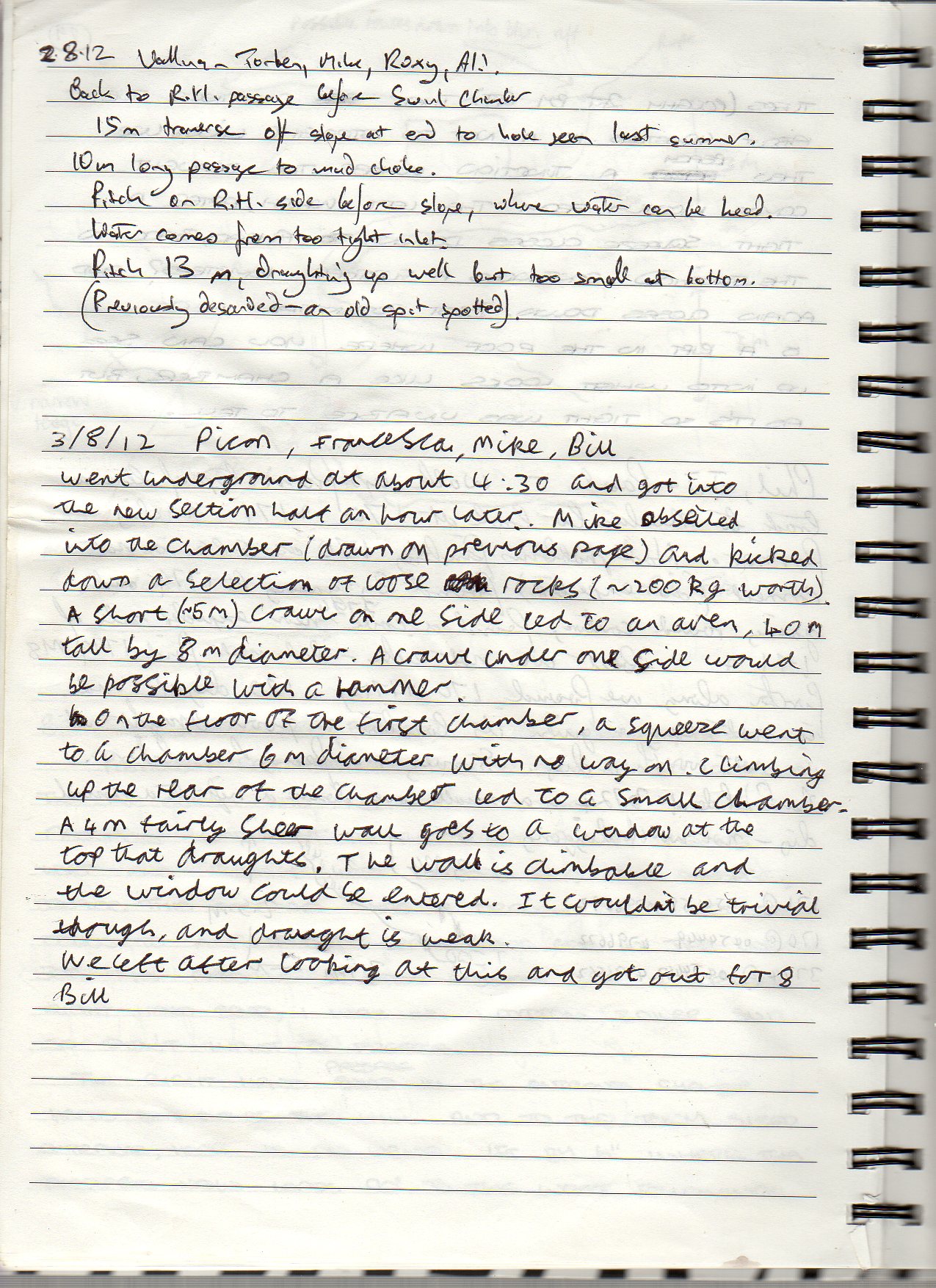
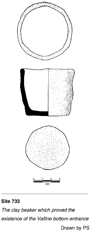
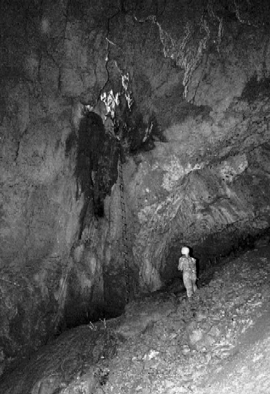
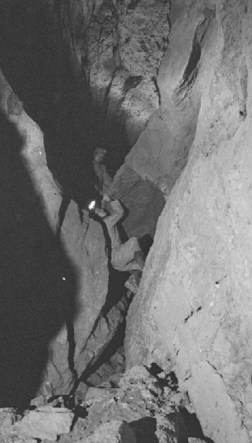
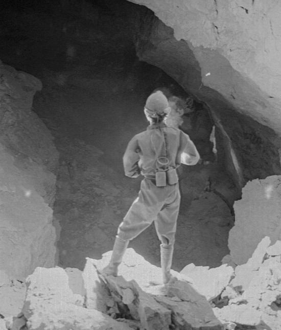
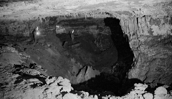
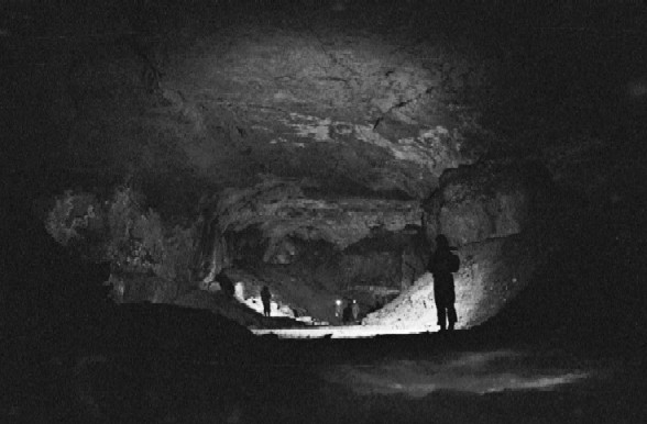
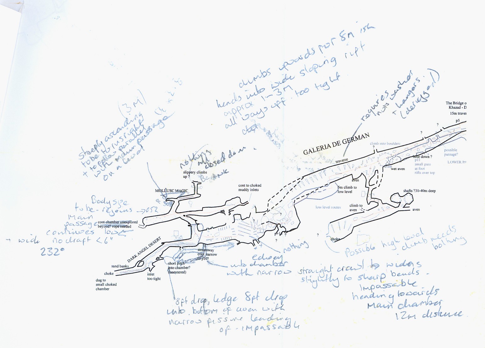
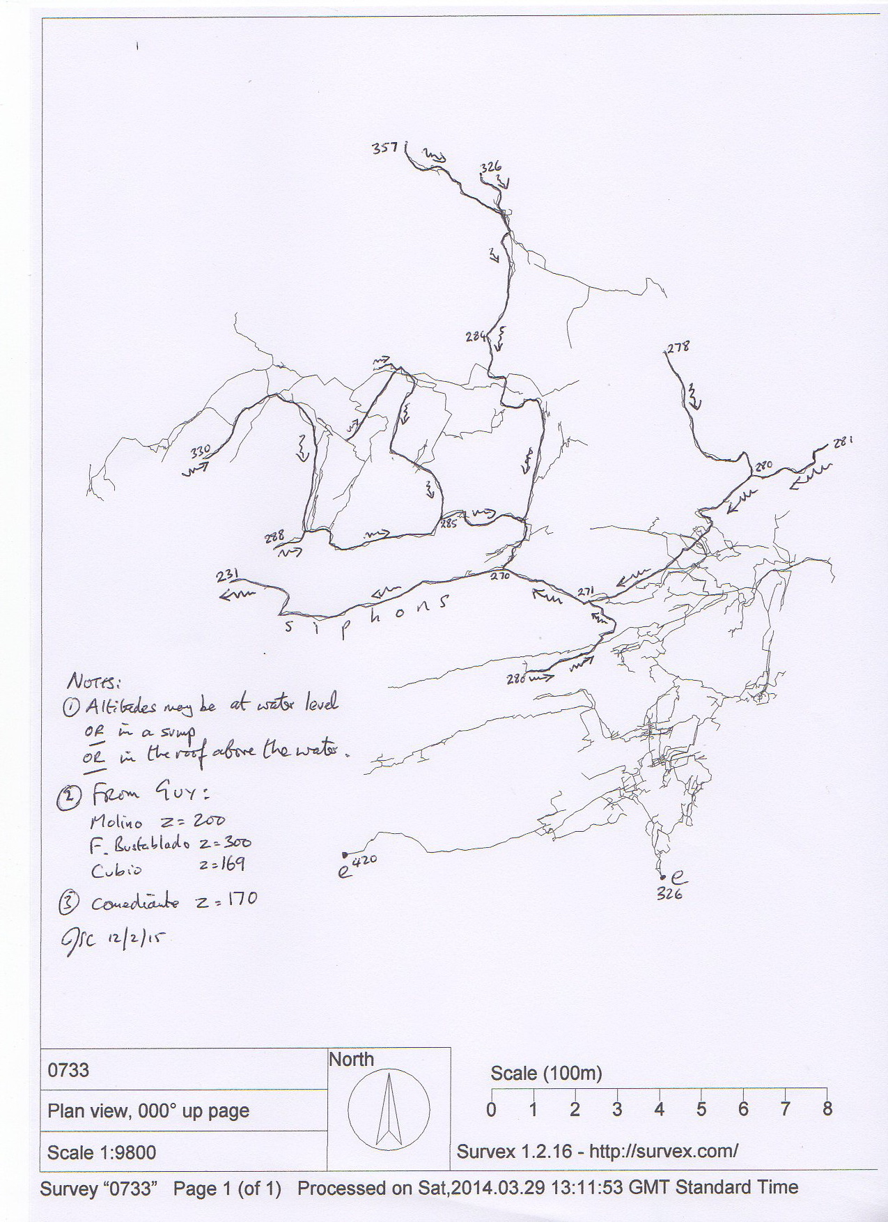