Updated 31st October 2007; 27th February 2018; 14th September 2021; 22nd June, 15th November 2022
A system discovered by the AEC Lobetum, and out of the current Matienzo
Caves permit area. It may have significance with regard to Cueva
de Fuente de la Pila, Vallina,
Torca de Portillejo de Tocornal or
Coquisera.
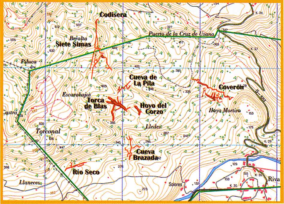
Valero Enrique y Soriano Ángel, 2007 has an
area map showing the following
sites: Rio Seco, Cueva Brazada, Torca de Blas, Cueva de
La Pila, Cueva de Coquisera and
Cueva del Coverón. The grid reference
(30T 0452898 4793271) was originally taken from this (small scale) map.
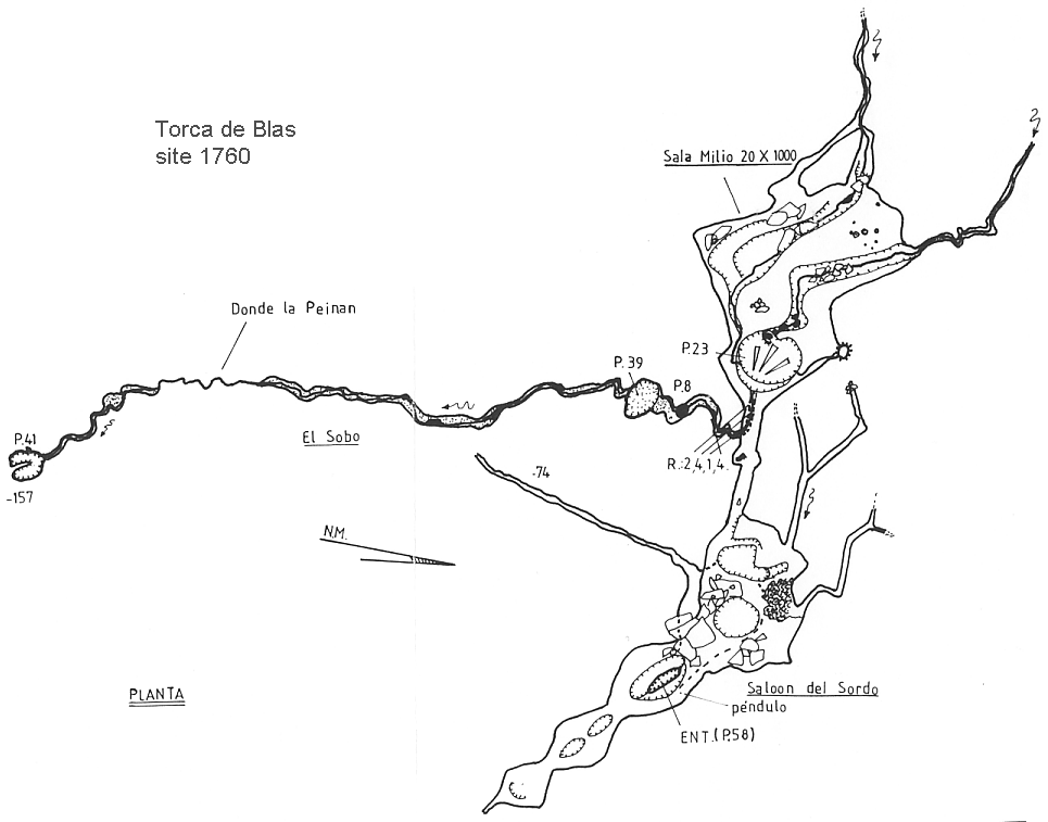
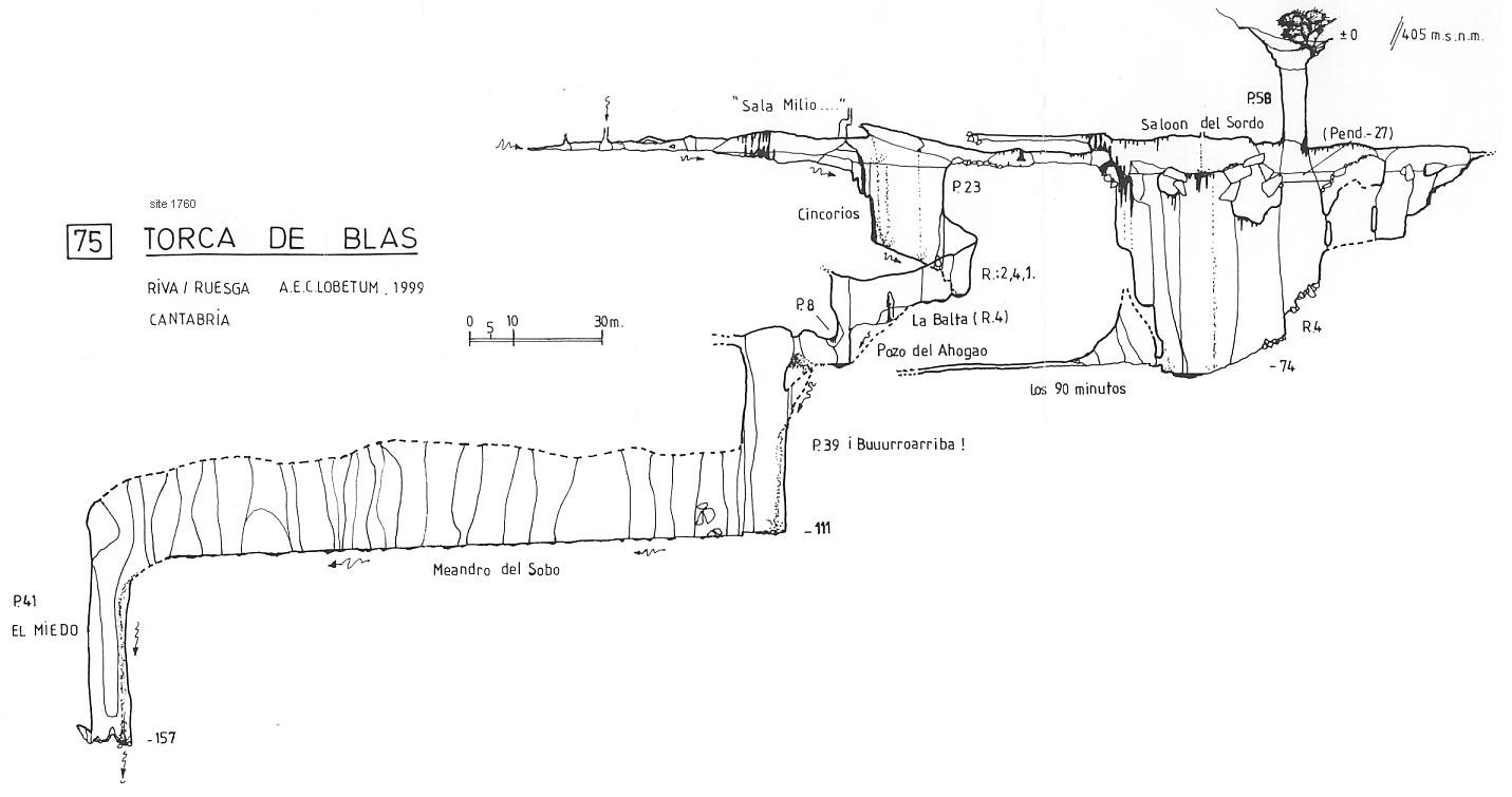
No description available. See survey links below. The reference below (Calar
No 5, 2000. Federación Castellano-Manchega de Espeleologia) has
a full survey but no description.
The survey in Valero Enrique y Soriano Ángel, 2007 is the same
elevation shown below. This publication has the length as 1050m and also
states that a passage in Torca de Blas ends very close to collapsed sediments
in Cueva de La Pila.
The site could not be found at this location when the area was visited in February 2018, but in July 2021, the entrance was located, GPS'd and photographed.
Reference: anon., 2000e; Corrin Juan, 2003b; Valero Enrique y Soriano Ángel, 2007 (survey); León García José, 2010 (Volume 1 and Volume 2) (survey); anon., 2018a (January / February logbook); anon., 2021c (summer logbook); Simonnot G, 2022
Entrance picture: July 2021
Underground picture(s):
Detailed survey: plan elevation (both from anon., 2000e: Calar No 5, 2000. Federación Castellano-Manchega de Espeleologia)
Line survey:
On area survey:
Survex file: Reconstructed from the 2000 survey