Updated 27th October 2001; 28th April 2002; 25th January, 2nd March 2003;
21st December 2008; 6th January 2011; 17th September 2014; 16th May, 28th September 2015; 29th November, 3rd December 2016; 17th September 2017; 5th May, 30th June 2018; 29th April 2024
See NOTE below
[Description updated by Alex Ritchie, Easter 2015]
The approach up the hill has become much more overgrown since the cave's discovery in 1983 and it is now more difficult to find the entrance. At Easter 2024 it was suggested that a better route is to approach via the track nearer the water pump and cross fields to the bottom of the dry valley then walk up the valley directly towards La Cuvia (#0086).
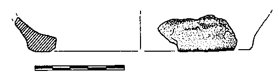
The cave crosses over Cueva de Carcavuezo (081) - the main tunnel is about 95m higher. The entrance lies above the cliff but, since the original explorations, the vegetation has grown requiring a more strenuous uphill approach to the cave (YouTube, summer 2014). Just inside was found some pottery and human bones which points to the site being a Bronze Age burial cave. Ruiz Cobo Jesús and Smith Peter et al, 2001 discusses this and has line drawings. The site is cited as a typical Bronze Age burial site in Smith P, Corrin J & Cobo J R, 2008.
The passage continues for 35m of 0.5m wide and 5m high, twisting, keyhole shaped passage. Part way along is a rift series (length = 63m), surveyed in April 2018, but not in the logbook. The entrance passage ends in a flowstone blockage with a hole at the top which has a strong but variable draught. This was dug out in 1991 and leads to a chamber with three ways on: one soon ends in a choked rift, the second is a climb up to a 50 - 70m pitch which is too tight at the bottom, the third is through a small hole in the floor. This enters a steeply descending, sandy hand-line rift into a 10m x 10m passage at around 230m altitude. The possibility of the entrance climb in the meandering fissure continuing on the other side of the main, lower passage has been checked out and ends at a blank wall. (An alternative description of the entrance passages can be found in the logbook, dated 31/7/2015.)
A visit on 30/3/2024 documented recent roof falls in the main chamber: massive collapse in chamber WITH MORE READY TO FALL. Don't go there.
Additional notes in the logbook from Sam Davis: The last time I went in this cave I was about 5 (now 37) years old, yet I remember dropping down the slope into the main chamber and seeing a few boulders, but not the monster ones we climbed over on this trip. Boulders appeared to be very fresh in appearance north of the entrance slope. I agree with Jim, I don't recommend going to the main chamber at least. The pitch nearer the entrance ~50m deep may still be a worthwhile exploration objective. On review of previous images (i.e. photo), several boulders now cover the place where someone is stood in the photo, with the roof changing from flat to classic breakdown shape.
See La Cuvia (0086) for a possble boulder collapse there.
The southerly route leads to large boulders, a shattered roof, various pretties, bones and a choke after some 60m. This has been penetrated for some 6m and further blackness can be seen. The area under the slab has been looked at and pushed to a small area with a mud floor and another very low bedding. Another look at this area is documented in the Easter 2002 logbook (3/4/02). A strong draught has been felt in places but nothing was felt on a visit 28/3/2015.
The northern route enlarges over large boulders, passes two, small choked passages with 5m pitches, and comes to some floor mud formations. It then swings to the left and chokes in boulders with a strong draught. A route through the boulders above the right-hand branch of the choke enters a small chamber with cow bones and an 8m high aven where tree roots can be seen.
On the right of the mud floor, an ascending sand and boulder slope narrows and meets a 9m ladder or handline pitch. Near here is a crawl which has still to be dug properly. At the base there is a hole in the floor which appears to choke. Straight ahead enters a narrow hading rift. A climb leads to walking passage and a parallel rift which is the way on. The passage leads through crawls to a 12m pitch in a phreatic tube (which can draught nearly as strongly as the entrance). (This section of text needs checking and possibly re-writing).
A small sandy crawl leads off to a small chamber. A fixed line is used to climb up into a steeply ascending rift with a route between two boulders which enters another rift which is very high. To the west, a climb using a fixed line leads up a very steep ramp to a section of easy walking passage. A small inlet on the right is choked.
A cross rift is met where the rock appears to have been pulled apart. Down this crack, between muddy walls, a section is entered where water trickles in. A traverse along a block with the ladder allows a drop down to a larger area which was descended at Easter 1993. A 30m pitch leads to a choked bottom and a very narrow way on which needs pushing. Seven metres from the base, a pendulum in the shaft led to a short climb and a small chamber with an arrow-head shaped rock in the bottom. There is also a small passage choked with mud and a second outlet with a short pitch into a 4m diameter, choked chamber.
It is possible to take a bold step or a run and jump across the crack and enter the continuation to a tight rift with a good draught but no way on.
In the summer expedition of '93 the pitch at the bottom of the "wet rift pitch" (discovered at Easter) was dropped to 6m depth with 15m of tightening passage.
A hairy climb above the inclined rift was also carried out which led through a tubular passage with gypsum sand and helictites on the floor and walls to the head of a 30m pitch. This lands on a sand slope which is blind at the foot.
Also in '93, possible holes in the floor of the main passage were checked: one was a 4m free-climbable pot.
The main passage (left and right) was looked at in the summer 2015. Several interesting avens were noted and a high level passage - all of which require bolting. The high level passage was reached in August 2017. A bolted climb of about 12m reached a roof traverse to a rift passage. Easy crawling for about 30m reached a blank wall. A 10m aven was free-climbed (overhanging calcite) to close down about 5m later. (These 2017 extensions have not been surveyed.)
Edited logbook notes from Easter 2023 follow. Can someone tie these in with the above, now fragmented, description?
RH from chamber entrance slope (east), side LH wall- down through calcite boulders. No way on. Could see through calcite grill 15cm high; continues for approx 1.5m but could continue up. Ferreted further, but no leads found. Fresh rock here and there from roof. LH (north) chamber side. Jim said he didn't remember lots of caravan sized boulders- Not like it used to be. Climbed up 13m over very large boulders and found hading rift passage marked on the survey LH side of chamber with undescended 5m pitch. Alex bolted y-hang to second y-hang (4 bolts) and Samuel descended remainder to floor. Floor had a sandy bottom but no leads. Surveyed out to new cairn at bottom of entrance rope climb down. (Survey data? GPS reading?)
On a visit early in January 2003, the following moths were noted hibernating
in the entrance and identified by Terry Whitaker.
3 Paignton Snout (Hypena obesalis)
10+ Twenty-plumed Moth (Alucita hexadactyla)
1 (dead) Herald Moth (Scoliopteryx libatrix)
References: anon., 1983b (logbook); anon., 1991 (logbook); Neill Ali, 1991; material in file; anon., 1992a (Easter logbook); Corrin J, 1992a; anon., 1992b (logbook); Corrin J and Quin A, 1992; Corrin J, 1993 (survey); anon., 1993c (Easter logbook); anon., 1993b (logbook); Neill Alasdair and Jackson Keith, 1993; Smith P, 1995 (survey); Smith Peter and Ruiz Cobo Jesús, 1999; Ruiz Cobo Jesús and Smith Peter et al, 2001 (includes drawing and survey); anon., 2002a (Easter logbook); anon., 2002d (Christmas logbook); anon., 2003a (February logbook); Corrin Juan, 2003b; Ruiz Cobo Jesús and Smith Peter, 2003 (survey of entrance passage); Smith P, Corrin J and Ruiz Cobo J, 2008; Ruiz Cobo Jesús et al, 2008 (survey); anon., 2014c (summer logbook); anon., 2015b (Easter logbook); 28th September 2015; Ruiz Cobo Jesús, 2016b; Smith Peter et al, 2016; anon., 2017c (summer logbook); anon., 2024b (Easter logbook)
Entrance pictures : yes : misc
Underground picture(s): yes : from Easter 2015 : from Easter 2024
Video: Approach to the entrance, summer 2014 : Pitch descent, Easter 2024 (YouTube)
Detailed Survey : entrance passage only (from Ruiz Cobo Jesús and Smith Peter et al, 2001) ; graph paper survey updated Easter 2015
Line Survey : On Four Valleys System line survey
On area survey :
Survex file : after Easter 2018 (Amended magnetic declination December 2013 to align with Eur79 grid and coordinates altered to fit ETRS89 datum, April 2014.)
On 4 Valleys + other caves (now)
Passage direction rose diagram: 30/6/2018