Updated 6th November 2003; 8th, 12th February, 27, 28th April, 23rd November 2024
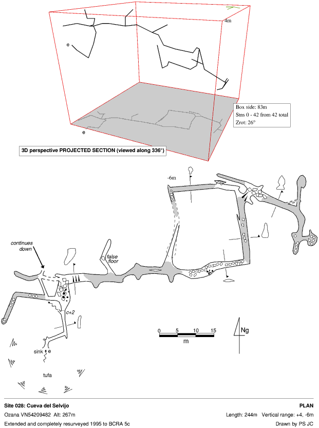
The cave was revisited, extended and resurveyed in October 1995.
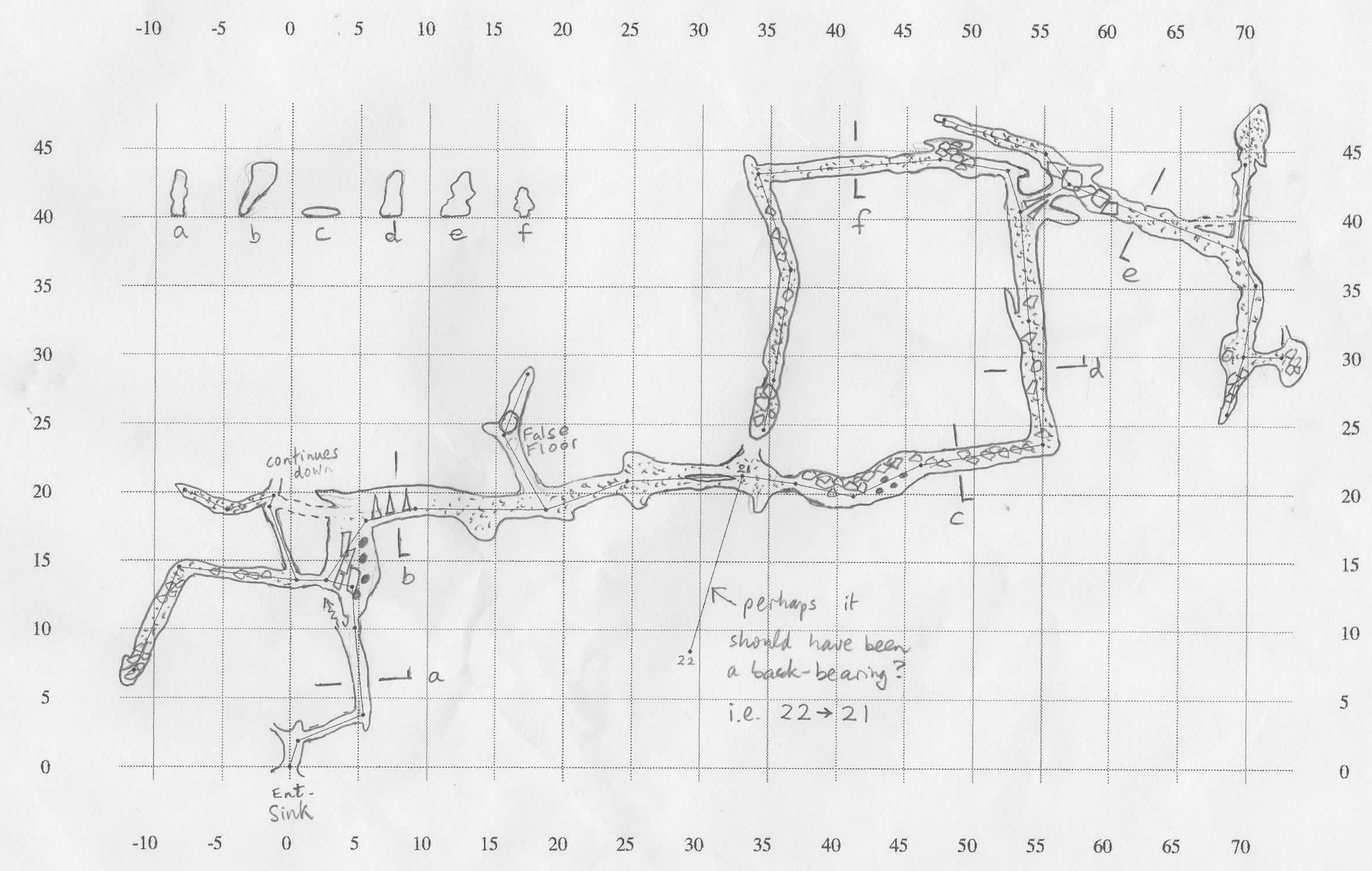
The original description of an uninspiring, wet cave does not fit! The cave was again re-surveyed for Survex detail in 2024 with a major extension to the south and other leads pushed and still going.
The deep, wooded entrance shakehole has a bank of tufa, formed below a small resurgence near the top of the depression. The water from this has coated earth pellets and other detritus to make large "pearls".
The low entrance chamber has two too-tight passages to the left that can take some of the water. The route down to the right reaches walking passage to a 3m climb up out of the stream and a once-tight squeeze into a chamber with calcite columns. To the left, a stooping passage rises to a choke, with a tighter route to the right which chokes to the left but continues down, unexplored.
Northern Passages
The main passage swings to the right, passing along a short traverse. At the base of the traverse, the downstream route is too tight. Over the top, and to the left, a false-floored passage soon chokes over a 10m-deep drop which is too tight about 3m down. Beyond a squeeze, further holes link down to El Dia del Padre Series. Some fine sediment banks are encountered with a climb up and over to the north into a route that has been excavated through a short, body-hugging crawl. After a total of 30m, the passage meets a cross rift with a crawl to the east appearing to get too low.
Back in the main passage, beyond a squeeze past formations, the cave lowers to a flat out crawl, entering larger passage
on a bend.
After a further 15m, at survey station 10, the passage divides at two 3m climbs down.
The laddered climb down to the north enters a nicely shaped vadose
passage which meets a hammer and chisel dig, after turning south - close to the main route already
traversed.
The eastern
climb encounters boulders and, continuing east, eventually chokes in all directions, with avens at the end of the passage after it has swung around to head south. Part way down the eastern climb, a passage heads off to the northwest to encounter, after an excavated squeeze, a sloping climb below a chamber with stal. A ladder is required on this 4m muddy, sloping drop.
At the bottom a low streamway is met that has been pushed in neoprene both up and downstream. An angular passage heads downstream for about 20m almost identical in character to the streamway in Cueva de la Loca 1. This goes around several bends to a low duck under roof pendants. The passage 'ends' immediately afterwards at a mud barrier blocking the passage completely (apart from a small bit of airspace above it). It could be dug by bicycle kicking it. Upstream starts with a flat out wriggle in the water and then became similar to the downstream. Several corners are negotiated until no more progress could be made: the passage was again blocked with mud in the floor, but this time there was enough space above it to slide oneself up into a narrow rift and look into a small but dry chamber ahead, with a loud sound of falling water. This might be accessible once the mud has been removed, but it is very possible that the rift will still be too tight.
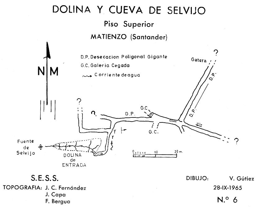
References: Fernández Gutiérrez et al, 1966 (survey); Kendal Caving Club and Manchester University Speleological Society, 1975 (survey); Manchester University Speleological Society, 1982 (survey); Mills L D J and Waltham A C, 1981 (survey); Corrin J S and Smith P, 1981; Ortiz E, 1968; anon., 2024a (January, February logbook); anon., 2024b (Easter logbook)
Entrance pictures : 1995, 2024
Underground pictures: 1995 and January 2024 : Easter 2024 : dig and pottery / bone, autumn 2024
Video : Easter 2024 : digs autumn 2024
Detailed Survey : from 1965: low res high res. From 1995: scale 1:1000 : original drawing for the 1995 survey : 2024 version 24.1 : 2024 version 24.3 : 2024 version 24.4
Line Survey :
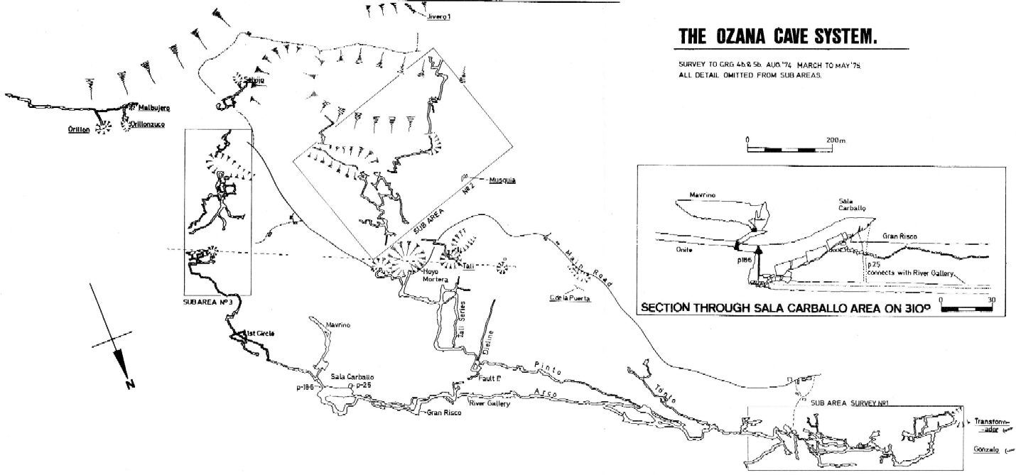
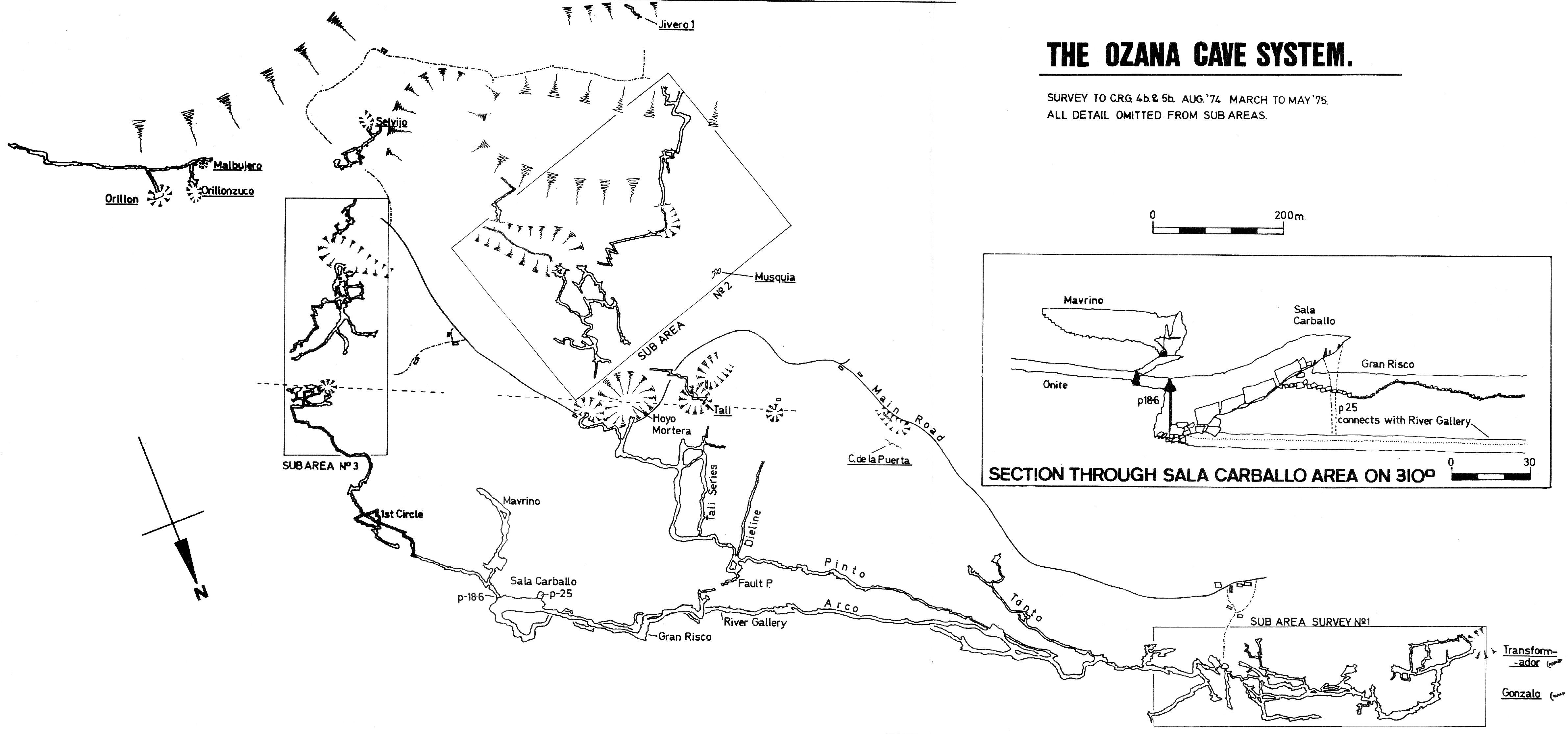
On area survey : 1975 Ozana area map. Not a lot of detail. low res high res
Survex file : Autumn 2024