Updated 19th February 1999; 6th January, 5th November 2011; 1st, 7th, 10th November 2015; 30th June, 22nd September 2018; 14th November 2022
The entrance is found on the west side of the depression. A choked hole at the base is site 4245 and a couple of holes (site 4246, where a stream is heard) are found on the east across a fence line in the wood. A small sandstone cave (site 4385) is found on the eastern slope. These are all shown on the surface survey included in the Survex file below. A tall wall in the doline remains an enigma.
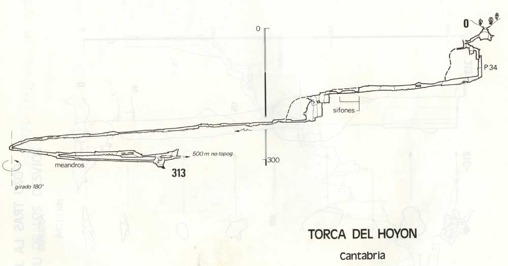
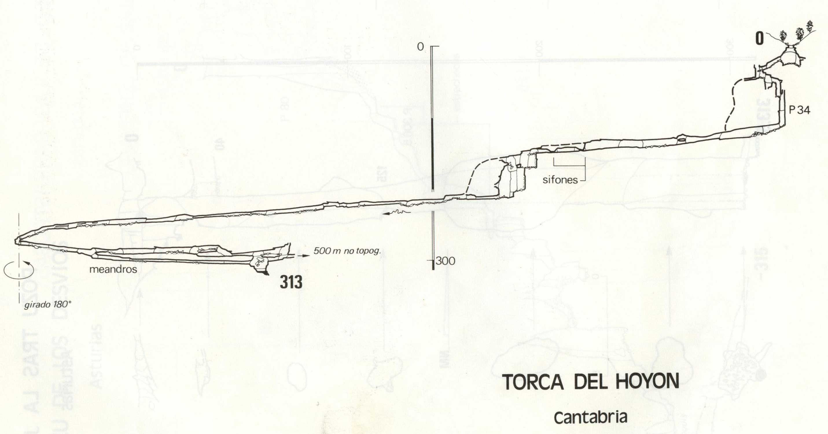
Entrance series of 5 pitches (more easily rigged for ladders) of 20m, 8m, 10m, 18m and 34m drops into the start of the 'meanders' which is 300m of traversing in the roof of a trench with a little water in the bottom. A drop down to floor level is followed by 100m of crawling which involves 3 wet-ear ducks and a stal grill all of which are liable to sump.
A large passage is met at the top of a large, muddy, bouldery pitch with another inlet on the left. The way on is a traverse over a rock bridge to the left with a climb down of 10m and an anticlockwise traverse through 270 degrees to a large, loose rock bridge which is the belay for the next 31m pitch. This area is very muddy and unstable with boulders falling spontaneously. At the base of the pitch 700m of large stream passage leads to a blockage at stream level. This can be bypassed by a nasty climb up, about 100m back from the blockage, into roof passages which drop into the stream where a stomp meets a large and clear sump. The draught apparently comes out of a choked bedding which is being dug. Side passages total about 1km in length; one of them heads towards Cueva del Molino (sites 791 and 727) near Bustablado which is at 200m altitude. The stream heads towards Matienzo and a possibly positive dye test has been carried out to Cueva del Comellantes (040).
Dives by French cavers in the Sumidero de Orcones at Bustablado (summer 2011) confirms the possibility of a downstream link to Cueva del Molino.
Link to entry in the Cave Diving Sump Index.
References: anon., 1985a (Easter logbook); anon., 1985b (logbook); Corrin J, 1986 (survey); Corrin J, 1987; pers comm.; material in file; anon., 1987 (logbook); Garcia J L, 1987; Corrin J and Knights S, 1988; Corrin J, 1992b (survey); García José León, 1997 (survey); Corrin Juan, 1997c; León García José, 2010 (Volume 1 and Volume 2) (survey); Papard Philip, Corrin Juan and Smith Peter, 2014; anon., 2015d (autumn logbook); anon., 2016a (January, February logbook); Simonnot G, 2016; Simonnot G, 2018; Simonnot G, 2022
Entrance picture : The entrance plus site 4245
Underground picture(s):
Detailed Survey : from rescue site low res high res
Line Survey :
On area survey :
Survex file : yes (Includes January 2016 surface survey) (Amended magnetic declination December 2013 to align with Eur79 grid and coordinates altered to fit ETRS89 datum, April 2014.)
Passage direction rose diagram: 30/6/2018