Updated 28th September 2023; 3rd May, 27th September 2024
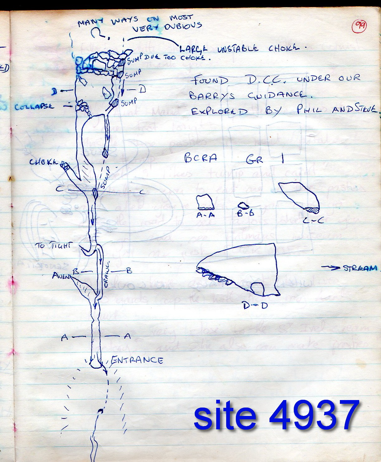
A prominant, dark feature is seen to the west of the main road from Beranga to Hazas de Cesto, about 180m south of the motorway viaduct. However, the feature is just dark shadow; the cave entrance is up the hill. The cave was first explored up to a choke by Matienzo cavers in 1977 and the detail sketched into the 1977 logbook, page 99.
The entrance, blocked by a tree trunk but with a strong draught, was partially opened up at Easter 2024 but the route forward was blocked by farm rubbish and this needed removing. The site was left stock-proof with a tyre and fence post.
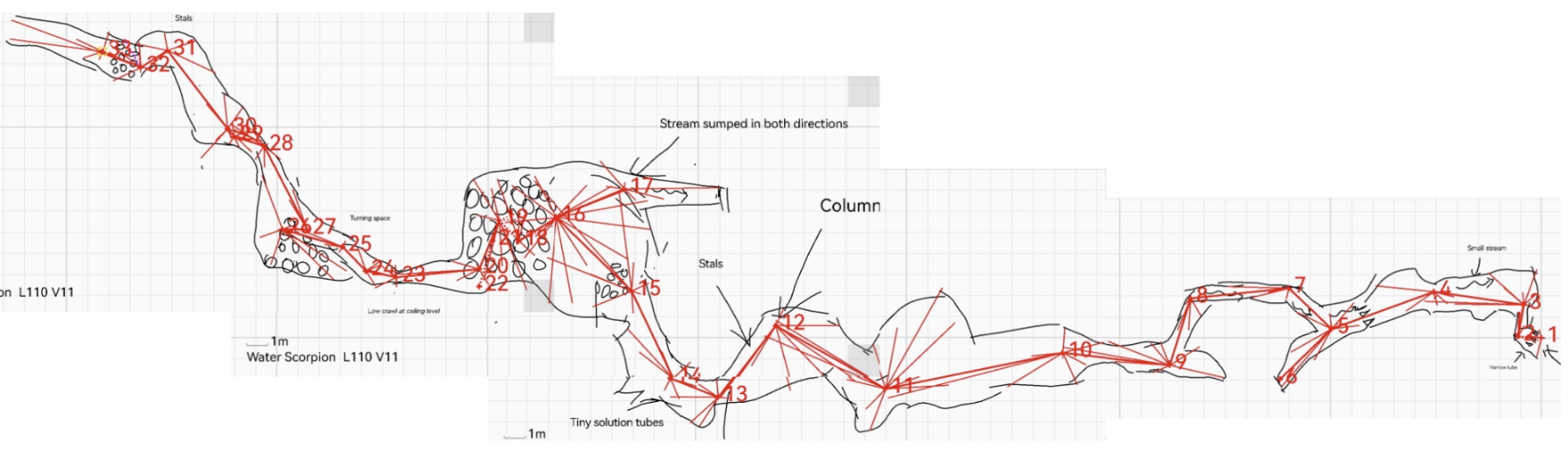
The cave was finally entered again 47 years later in August 2024. A narrow descending tube enters a small chamber. The stream flowing through has water scorpions and leeches. The passage runs upstream, through a small tube and past a column then a chamber and boulder choke that was the previous limit. This was earlier described having "many leads, most very dubious".
All leads were probed and only one goes any distance. From a climb up in the boulder choke, a flat-out crawl goes through formations. This leads to a small turning space and a narrow slide down into a chamber of sorts. This seems to be through the boulder choke and the way on is a draughting passage with blocks ahead which took a fair amount of hammering to open a space through. A small chamber is entered with a fairly strong draught. There are a few small holes up loose climbs that look uninviting, but the draught is coming from a sandy tube which has been followed to a boulder choke, at the end of a flat-out crawl. There is a draught here but it is doubtful anyone will ever bother to dig it. [Description edited from logbook entries.]
The old exploration to the choke was found to be 72m, beyond added another 50m.
With some interesting features showing on the LIDAR map of the woodland to the south west a search was started at the lowest part of this wood. Thick undergrowth made for difficult going with no trace of any limestone showing by the time the top of the wood was reached. The LIDAR features showing up seem to be large mounds of earth and clay, with no prospects at all. [logbook, John Southworth]
[A grid reference for the feature visible at the road side is 30T 453104 4806518]
References: anon., 2019b (Easter logbook); anon., 2023c (summer logbook); anon., 2024b (Easter logbook); anon., 2024d (summer logbook)
Entrance picture : April 2019 : April 2024 : August 2024
Underground pictures : August 2024
Video :
Detailed survey : sketch from the 1977 logbook : combined 2024 drawings from survey instrument : final, drawn survey
Line Survey :
On area survey :
Survex file : 2024