Updated 7th, 18th November 2009; 18th May, 16th October, 1st December 2011; 14th, 26th January, 29th April, 29th November 2012; 6th October 2013; 23rd May, 26th September 2014; 7th January 2018
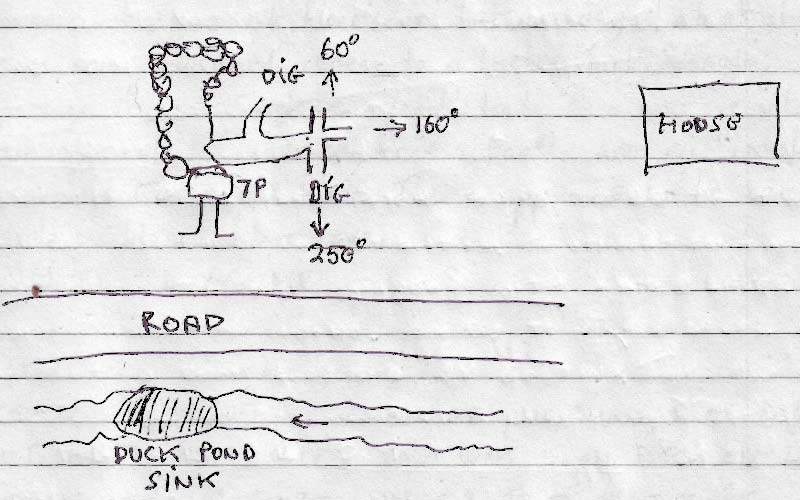
An old cold store above and on the other side of the road from site 1976, the "duck sink". The feature is a hading rift about 0.8m wide blocked with boulders but draughting.
It has been dug out on a number of occasions but underpinning boulders holding up the back wall of the store is now required.
This is a good prospect but needs a bit of engineering work.
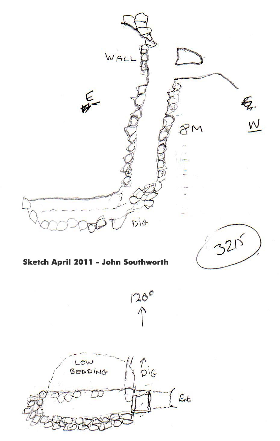
At Easter 2011, a low bedding was entered at the base of an 8m deep climb down through boulders. The base is at about the level of the river and there may be further digging prospects.
More excavation occurred in the summer, 2011 and, in the autumn, the sandy dig was excavated to a three-way junction with room to start excavating the right hand branch (at 250 degrees) following the draught. Further excavations were carried out in December 2011 to a point where it needs "a small caver" to look at prospects for the next section.
At Easter 2012, further excavation removed a large boulder and progressed about 1m along the crawl.
In the autumn, the dig marked on the survey at 250 degree was extended 1m at which point a large sandstone boulder in the floor stopped progress.
In the summer 2013, the very low passage met an "upward boulder choke" which effectively stopped digging in the right hand branch. Another dig entered a small chamber but more digging is required. The entrance has started to become unstable and more shoring is planned for Easter 2014.
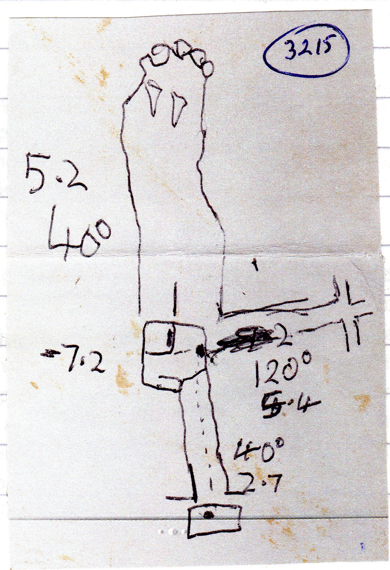
Over Easter 2014, the entrance was re-shored and a route through excavated into a 10 x 6 x 5m high chamber with ways on "everywhere" in a large boulder choke. More draught is required to find a good route through. A survey gives a total length of 122m. In the summer, two more trips attempted to follow the draught but without success.
Reference: anon., 2009a (Easter logbook); anon., 2009c (summer logbook); anon., 2011b (Easter logbook); anon., 2011d (summer logbook); anon., 2011e (autumn logbook); anon., 2011f (Christmas 2011); anon., 2012b (Easter logbook); anon., 2012e (autumn logbook); anon., 2013d (summer logbook); anon., 2014b (Easter logbook)
Entrance pictures: yes
Underground pictures : 2009 : 2011 : summer 2013
Video :
Detailed Survey : sketch : sketch 2011 : sketch, autumn 2011
Line Survey :
On area survey :
Survex file : yes (Amended magnetic declination December 2013 to align with Eur79 grid and coordinates altered to fit ETRS89 datum, April 2014.)