Updated 9th May; 6th June 2018; 2nd May 2024
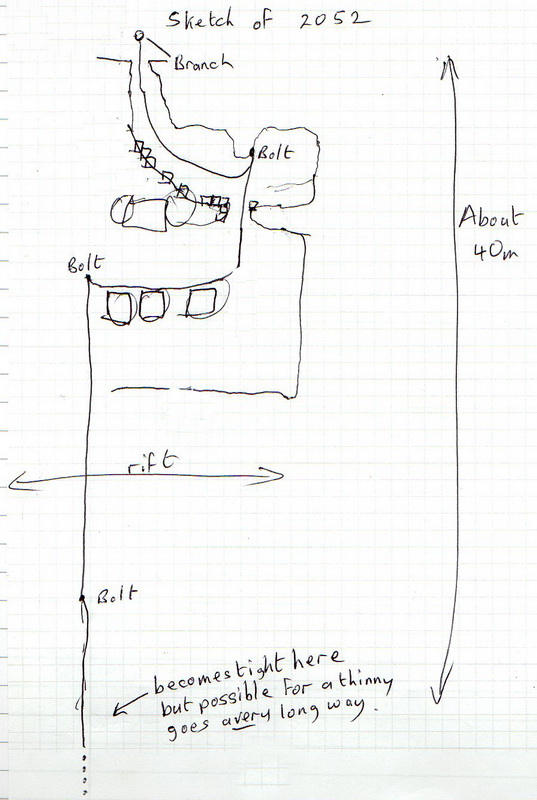
Originally described in 2004 as, "An undescended, sloping rift of about 4m depth with 3 or 4 rocks covering
the widest part", the hole was descended 14 years later for 40m in a deep rift to where it becomes tight. The rift continues to a possible shelf and the route down should be possible for "thinnies". Boulders fall a considerable further distance.
However, when the shaft was part-descended in April 2024, there was a different description:
The shaft starts a little tight but soon opens out slightly at least to the first ledge at about 8m down. Another 8m drop reaches a solid(ish) ledge. From here there is a squeeze into a parallel shaft. About 5m further down is the next constriction and an even tighter hole 5m lower. Rocks knocked down from here fell 10 - 15m, not 50m+ as we were told, nor was the really tight bit at-40m. Estimated, we got to about -25m possibly lower than the constriction that stopped the previous trip. In total, the cave is estimated to be about 40m deep, including the undescended bit below. The only draught was probably from the wind above, as it was on and off and reduced the further down the shaft. [Edited from Alex Ritchie logbook account.]
Reference: anon., 2004b (Easter logbook); anon., 2018b (Easter logbook); anon., 2024b (Easter logbook)
Entrance pictures: 2004 and 2018
Underground picture(s):
Video:
Detailed Survey : elevation sketch, Easter 2018
Line survey:
On area survey:
Survex file: