Updated 18th January 2004; 20th January 2022
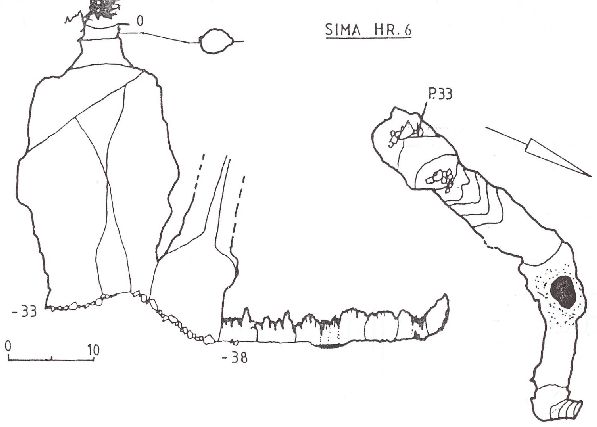
Shown in Actividades Regionales. Exploraciones en Cantabria (anon.,
1993a) as site 13. Approximate grid reference taken from the map in the same
booklet. The 33m entrance pitch has a tree at the top and drops into a well
decorated passage.
Reference: anon., 1993a (survey)
Entrance picture :
Underground picture(s):
Detailed Survey : from anon., 1993a (AEC Lobetum): high res low res
Line Survey :
On area survey :
Survex file : Reconstructed from the 1993 survey