Updated 30th August 1998; 19th February 1999; 12th December 1999; 8th November 2003; 20th November 2008
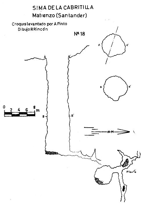
The entrance is an impressive shaft indicated by trees (at least Strawberry
Tree and Holm Oak) on a bare, steep hillside. A 25m pitch ends on boulders
into a small chamber from which 3 passages radiate. Both left hand branches
quickly choke. The right hand branch continues as stooping or crawling over
sand for 100m. Near the end is a blowhole in solid rock, about 10cm diameter
for at least 2m. The floor seems to be a boulder which may lead to easier
digging once removed, but the site is not paricularly promising. Several
possible digs on the southeast side of the passage back towards the entrance
draught slightly.
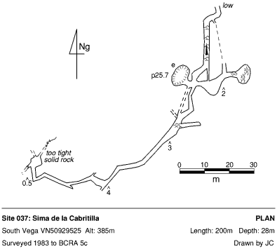
In 1999 "various new bits" were found near the entrance, but none went.
References: Fernández Gutiérrez J C, 1975; Corrin J S and Smith P, 1981; Corrin J, 1983c; anon., 1983a (Easter logbook); anon., 1983b (logbook); Corrin J, 1983b; material in file; anon., 1998c (Christmas logbook); anon., 1999c (logbook); from 2008f (autumn logbook)
Entrance pictures : yes
Underground picture(s):
Detailed Survey : from 1965: low res high res.
1:1000
Line Survey :
On area survey :
Survex file : yes (Amended magnetic declination December 2013 to align with Eur79 grid and coordinates altered to fit ETRS89 datum, April 2014.)