Updated 6th November 2003; 14th June 2008
Passage to the right of the entrance chimney leads to a drop into walking
sized passage and then to a passage of pools and mud banks. A short swim
leads to a narrow canal with deep water and a sump.
The other direction from the entrance involves crawls and squeezes to a
chamber.
In the spring of 2008, the entrance shakehole was used as a dumping ground
for soil and building waste from Arredondo. The entrance was covered over
before any action could be taken to stop the work. The site is part of the
Cantabrian government protection area around Risco and the dumping should
not have happened. It has now been halted with the shakehole partially filled
in.
References: Fernández Gutiérrez et al, 1966 (survey); anon., 1975b (Easter and summer logbooks); Kendal Caving Club and Manchester University Speleological Society, 1975 (survey); Manchester University Speleological Society, 1982 (survey); Mills L D J and Waltham A C, 1981 (survey); Corrin J S and Smith P, 1981; anon., 2008d (Whit logbook); Corrin Juan, 2009
Entrance picture : partially filled shakehole
Underground picture(s):
Detailed Survey :
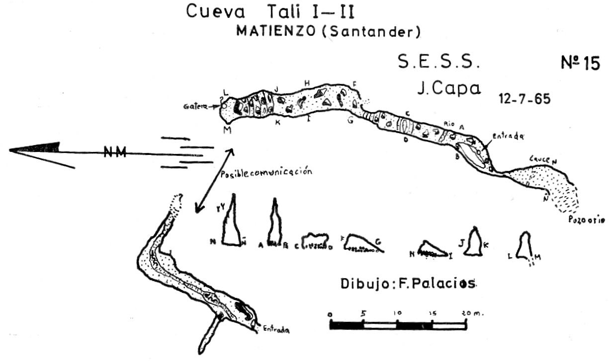
Line Survey : from 1965, with Tali I low res high res
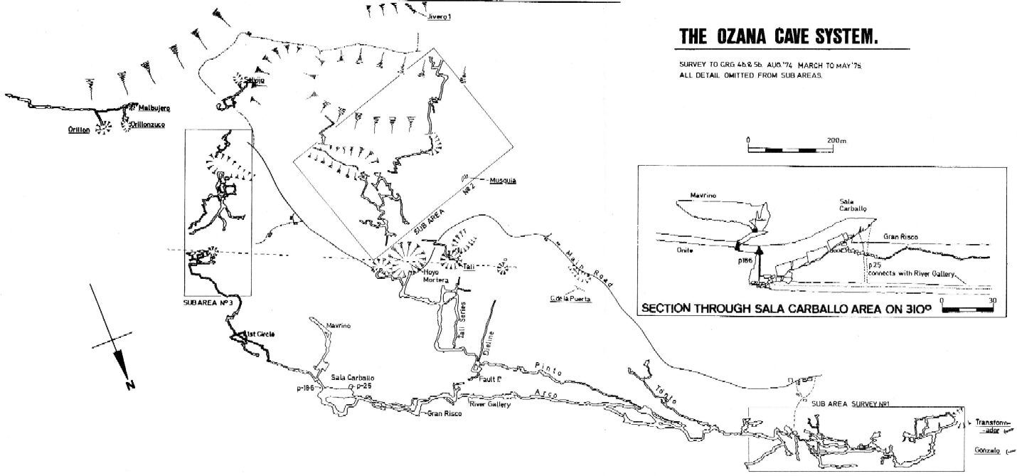
On area survey : 1975 Ozana area map. Not a lot of detail. low res high res
Survex file :