Updated 24th May 2014
An archaeological site, a few metres higher and to the right of site 847, Cueva de Concervera. (The grid reference is a guess based on a GPS reading for site 0847 which, in turn, put that cave's position 100m N of a position from a map. The original grid reference for Concervera II is ETRS89: 30T 456184 4796118).
Reference: Ruiz Cobo Jesús and Muñoz Fernández Emilio et al, 2009 (survey); anon., 2014b (Easter logbook)
Entrance pictures:
Underground pictures :
Video :
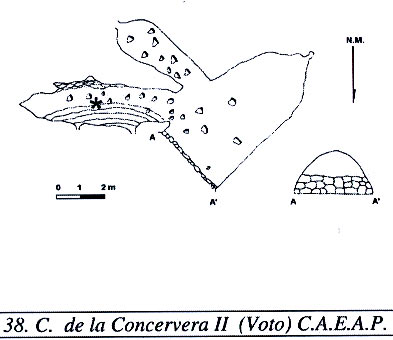
Detailed Survey : from Ruiz Cobo Jesús and Muñoz Fernández Emilio et al, 2009
Line Survey :
On area survey :
Survex file :