Updated 13th January, 26th April, 26th September 2012; 24th April 2013
This site is now best approached from the Arredondo side of the hill. A small hole in the edge of the wood has a good draught and is diggable. When visited in December 2011, there was a very good, warm draught out. An easy dig was also found 1m to the east.
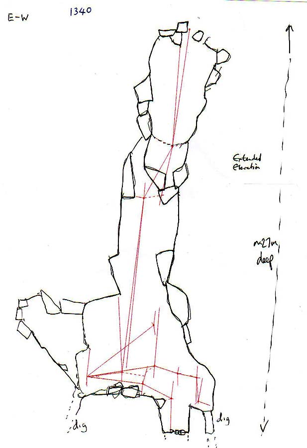
The site was opened up at Easter 2012. A p12 drops in a rift to the next pitch of 15m. The base is 8 x 5m with 3 possible further digs going off to the north, south and east. The best may be to the south where it appears a small stream may sink in wet weather and rocks can be dropped 2m to a floor. No draught when descended at Easter.
In the summer, 2012, there was no or little draught from the digs but at Easter 2013 it was found to be draughting in strongly.
Reference: anon., 1998d (logbook); anon., 2011f (Christmas logbook); anon., 2012b (Easter logbook); anon., 2012d (summer logbook); Corrin Juan, 2013a; anon., 2013b (Easter logbook)
Entrance pictures: Xmas 2011 : Easter 2012
Underground picture(s): Easter 2012
Video: Exploration of first pitch
Detailed survey: from DistoX and PocketTopo : plan and extended elevation
Line survey:
On area survey:
Survex file: yes (Amended magnetic declination December 2013 to align with Eur79 grid and coordinates altered to fit ETRS89 datum, April 2014.)