Updated 5th May 2001; 26th April 2012; 22nd May 2017
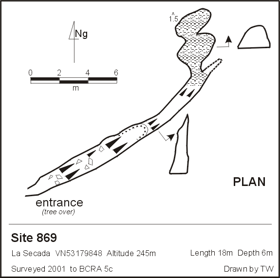
An open 5m x 1.5m rift which has a 3m climb to a descending mud floor to
a choke. A possible dig but no draught. Tagged 869.
The site was revisited at Easter 2012 and described as "a big rift with an obvious mature tree at one end. A handline is required "to get out again" and the rift shows signs of solution.
The pre-GPS grid reference was
VN53179848 Alt. 245m; ETRS89: 30T 453068 4798271;
a 2012 GPS put the hole at 30T 453068 4798271;
the 2017 GPS position is shown above
Reference: anon., 1991 (logbook); anon., 2001a (Easter logbook); Corrin Juan, 2003a; anon., 2012b (Easter logbook); anon., 2017b (Easter logbook)
Entrance picture : Easter 2017
Underground picture(s):
Detailed Survey : 1:200
Line Survey :
On area survey :
Survex file : yes (Amended magnetic declination December 2013 to align with Eur79 grid and coordinates altered to fit ETRS89 datum, April 2014.)