Updated 5th October 2010; 20th September 2012; 22nd July 2015
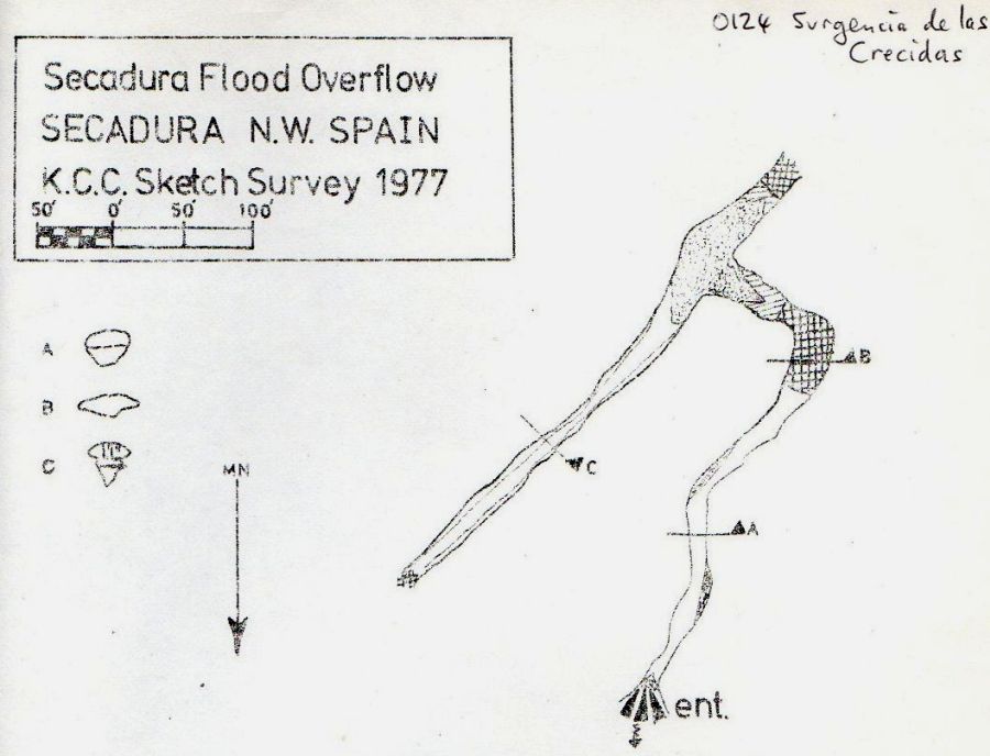
A 70m swim leads to a sump of 3m. A short squeeze over a silt bank to the left leads
to a T junction. Downstream to the left is walking / swimming in an out-of-depth canal for 30m to a choke near
to the surface. Upstream ends after 15m at a second sump which gets too low
after 3m. By continuing straight on in the 3m sump an arch is met an progress continues underwater to a large choked area which blocks the passage. The site was completely re-explored and extended by Simon Cornhill in the summer 2012. The 1977 and 2012 sketches show what was done on each visit. Note that north is towards the bottom of each sketch with the pdf survey showing north up the page.
This could be a flood rising for Los Boyones
(117) (quite likely as the passages have lots of silt) but could also be a resurgence for an unknown system.
Link to entry in the Cave Diving Sump Index.
References: Corrin J S and Smith P, 1981; Manchester University Speleological Society, 1982; anon., 1977a (survey); anon., 2010c (summer logbook); anon., 2012d (summer logbook); Corrin Juan, 2013a
Entrance picture : yes
Underground picture(s):
Video : Simon Cornhill exploring and extending the cave in 2012. (YouTube)
Detailed Survey : 1977 sketch : 2012 sketch > pdf survey
Line Survey :
On area survey :
Survex file : yes