Length of 800m included in Cueva de Suviejo (122)
Updated 19th February 1999; 9th November 2003; 17th November 2007; 6th, 18th January 2011; 21st April 2013; 30th June 2018
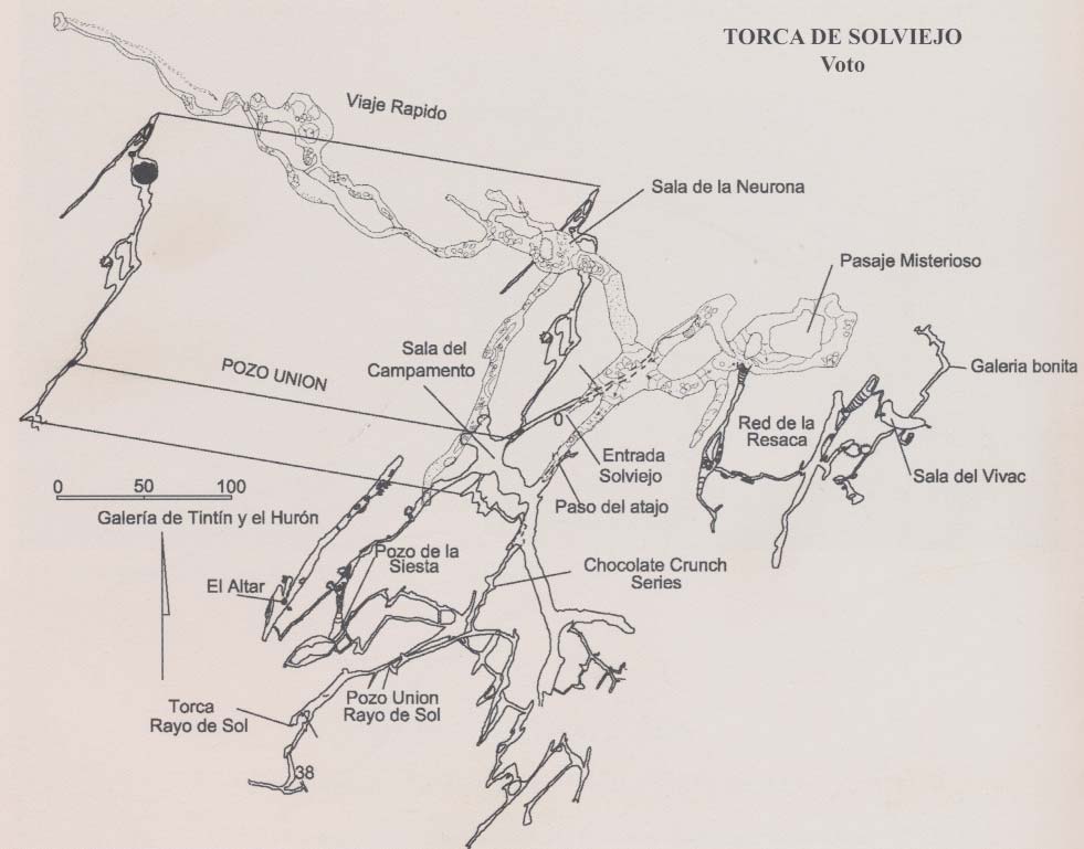
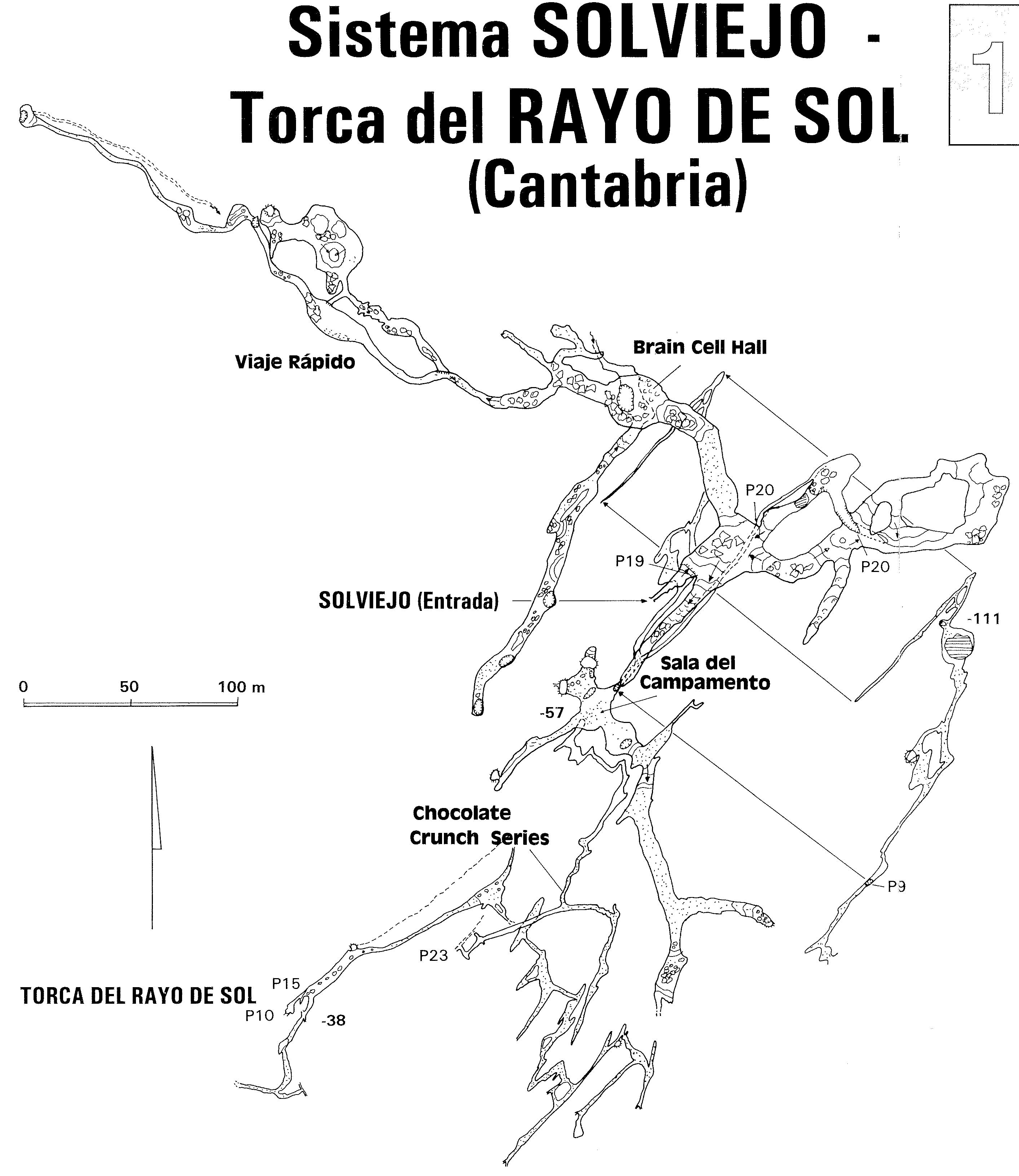
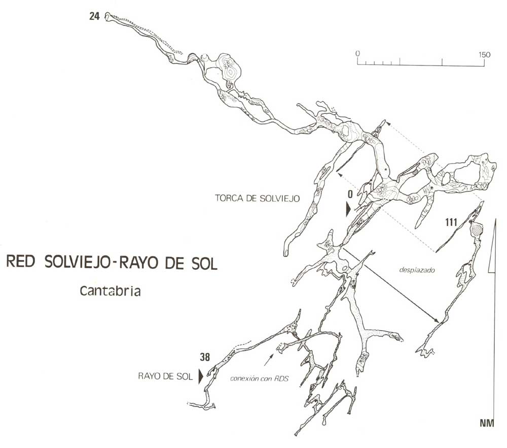
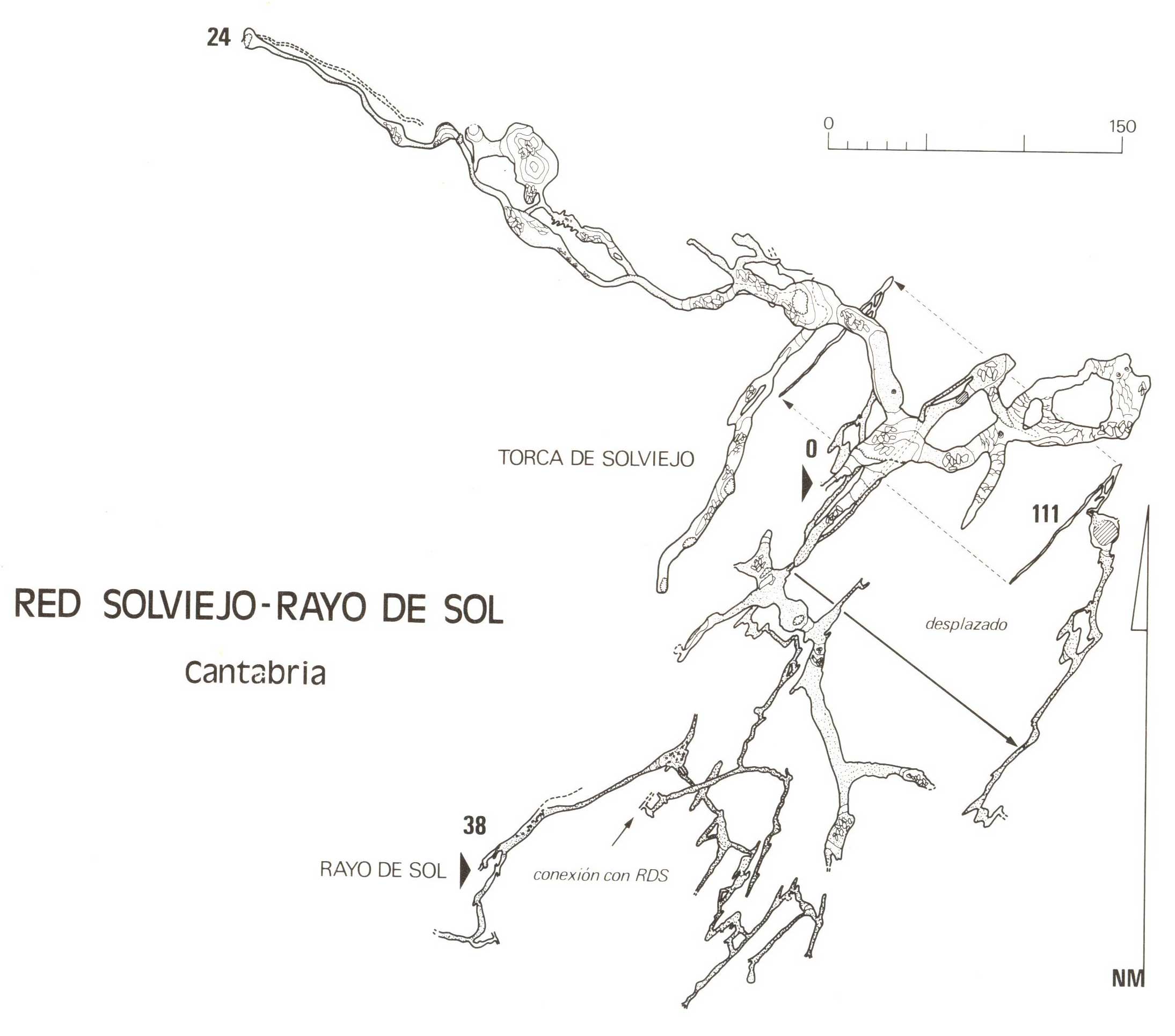
The entrance is in the true left hand bank of the stream bed and is a 7m pitch with a tight take-off. The landing is in a 5m diameter chamber with a short crawl on the left leading to the head of a 15m pitch which lands in a hading fault passage.
At the base, to the southwest the passage descends three steps and enters an aven. Three metres up the left hand wall a crawl goes off and branches. The left hand passage closes down while the other continues over cobbles. This route was not explored by the Matienzo Expeditions until 1995, but appears to have been dug open. The crawl continues to an enlargement with a lump hammered hole in the floor to a descending tube and mud choke. A crawl over the hole in the floor enters a climb down to a gravel choke. A small goes back underneath to a mud choke. The larger aven and rift above the final gravel choke may be accessible with climbing / bolting gear, but there is no noticeable draught.
To the northwest of the second pitch the high and narrow passage heads down the fault for 90m. Holes above here connect with Cueva de Suviejo (122) as shown on the 2010 survey. The passage then breaks out into a lofty chamber. On the right of the chamber a low crawl leads into a series of dusty, phreatic chambers linked by short crawls.
References: anon., 1976 (logbook); Cope J et al, 1976 (survey); Corrin J et al, 1978 (survey); Mills L D J, 1981; Corrin J S and Smith P, 1981; Manchester University Speleological Society, 1982 (survey); material in file; GEISC/R and CAEAP, 1986 (survey); Corrin J and Quin A, 1992 (survey); Corrin J, 1993 (survey); material in file; anon., 1995c (logbook); García José León, 1997 (survey); León García José, 2010 (Volume 1 and Volume 2) (survey); anon., 2013b (Easter logbook)
Entrance picture :
Underground picture(s):
Detailed Survey : from 1976: low res high res
from rescue site tif low res high res jpg low res high res
Line Survey :
On area survey :
Survex file : download : with others close by, and Cueva Fresnedo (Coordinates altered to fit ETRS89 datum, April 2014.)
Passage direction rose diagram: 30/6/2018