Updated 6th November 2003; 21st February 2016; 6th November 2023
The entrance is 2.5m high and leads to walking-size passage. A narrow rift on the left takes the stream when it's flowing in the cave. Two side-passages on the right soon become too small. After about 40m a narrow passage is reached that opens up at a junction, with a boulder slope and piles of rubbish straight ahead. The rubbish comes from a shakehole in the field above the cave that now seems to be blocked by an old washing-machine or similar.
To the left at the junction, a squeeze leads to a wide bedding-plane area where, to the south-east, a hole might lead to a small continuation. To the west a crawl connects with the main passage. Turning right at the junction, a short passage again on the right splits into a narrow rift and slope upwards that gets too small. The main passage continues as a crawl that drops into a small chamber and then gradually decreases in size. After about 30m it turns 90° and continues for another 30m until it becomes extremely low.
While the cave has hardly any speleothems, there are pendants throughout the cave, some of them resembling stalactites. Half-tubes of different sizes are seen in the roof in different parts of the cave. At the entrance, a narrow tube and the roof have numerous holes bored into the limestone by snails.
[Peter Smith]
During an optical brightener test from site 3884, detectors were placed here from 13th February 2016 and checked over the next few days in rising and falling flood conditions. The results were consistently negative. The optical brightener came through at the Jivero 1 resurgence after 48 hours. (The full details can be found here.)
References: Fernández Gutiérrez et al, 1966 (survey); anon., 1974a; anon., 1975b (Easter and summer logbooks); Kendal Caving Club and Manchester University Speleological Society, 1975 (survey); anon., 1975a; Mills L D J and Waltham A C, 1981 (survey); Corrin J S and Smith P, 1981; anon., 2016a (January, February logbook); anon., 2023d (autumn logbook)
Entrance pictures : 2023
Underground pictures: 2023
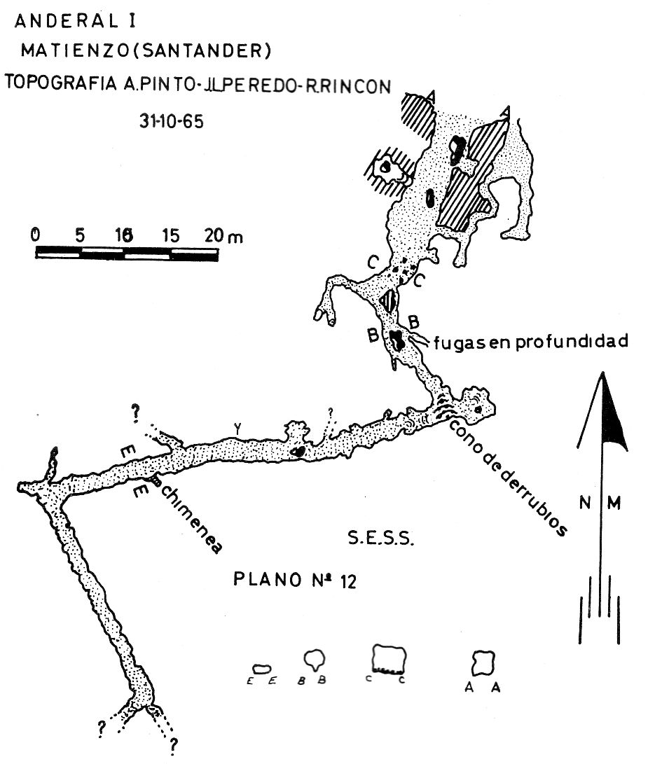
Detailed Survey : from 1965: low res high res : from 2023
Line Survey :
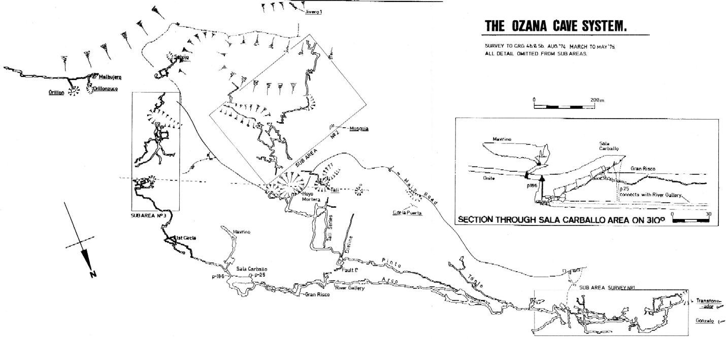
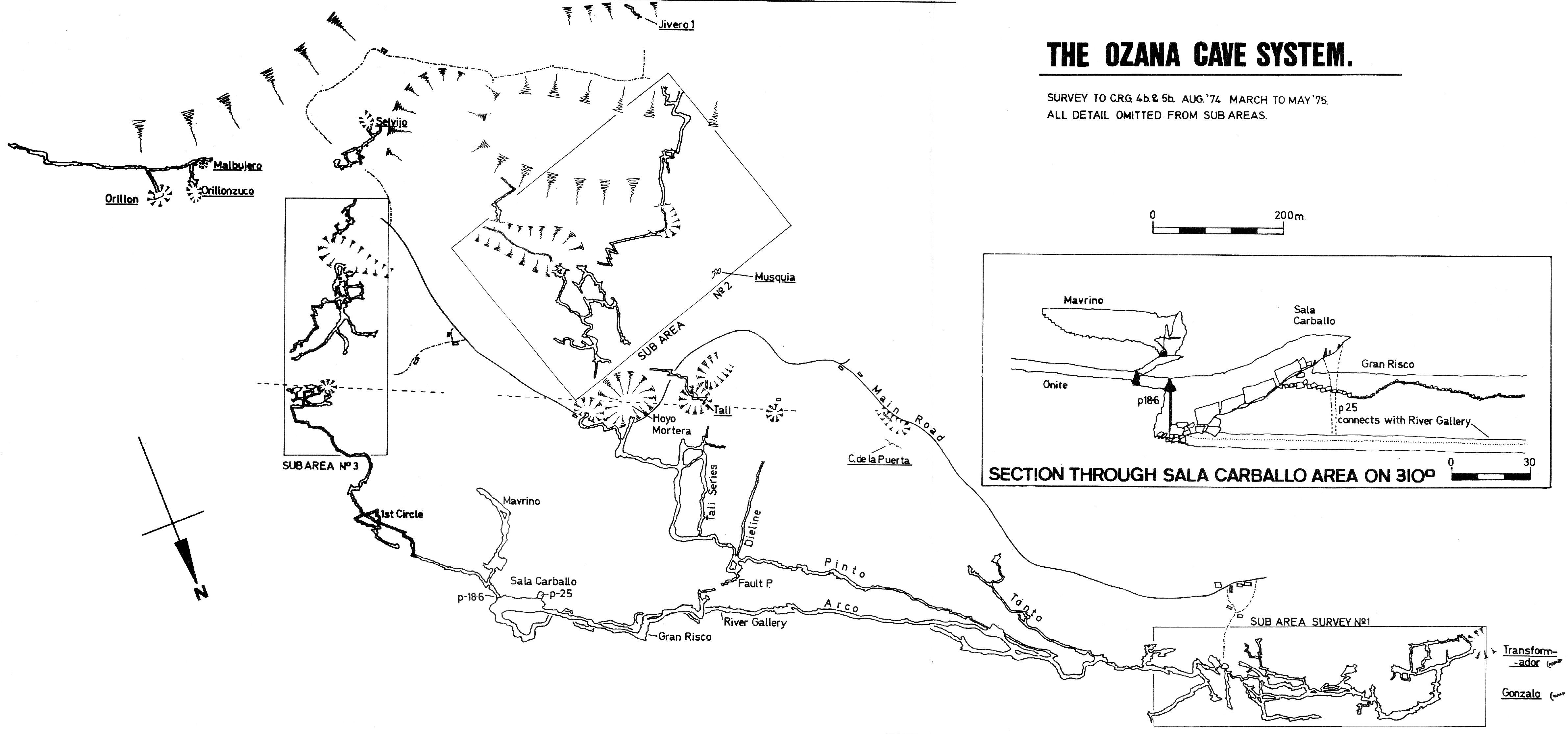
On area survey : 1975 Ozana area map. Not a lot of detail. low res high res
Survex file : 2023